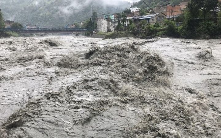
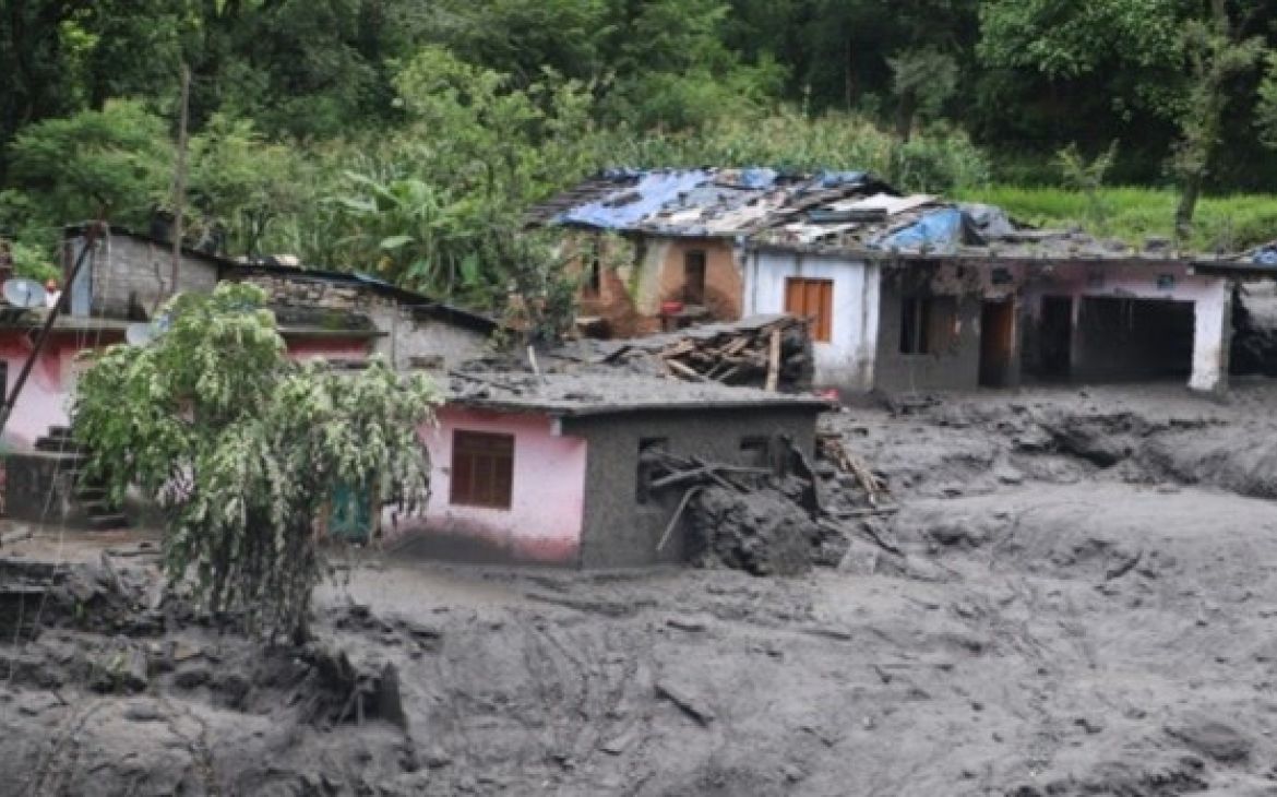
09 November 2021, Geneva, Switzerland - In South Asia, the monsoon season started early and forcefully this year. Nepal was particularly hit by heavy rainfall in June 2021: flooding and landslides were reported in many parts of the country and affected thousands of families*.
In August, rainfall intensified again for several consecutive days, with rivers overflowing, landslides triggered across the hills, and widespread inundation in the southern plains. In the affected areas, many houses, informal settlements, and other buildings were destroyed, forcing people to seek refuge with relatives or in temporary shelters*. Health and sanitation concerns arose as access to running water became limited, increasing the risk of water-borne disease transmission, and limiting the ability to adhere to preventive measures against COVID-19.
Nepal is a hazard-prone country. Recurring disasters have been monitored throughout the years, including severe floods in 2008, 2014, and 2017, and the devastating earthquake in 2015. National authorities were concerned this year as weather extremes and above-normal rainfalls were expected, particularly in areas of the country affected by the earthquake and facing resulting higher landslide risks.
UNOSAT in Nepal
In 2015, following the 7.8-magnitude earthquake, UNOSAT's Emergency Mapping service was activated to provide satellite-derived damage assessment in support of the humanitarian response efforts on the ground. Acting as coordinator for mapping products, UNOSAT integrated the results from various sources in a publicly available webmap. Very innovative at the time, this online viewing tool gathered all the analysis results. It also showed images collected from the ground through the newly developed UN ASIGN app. With the crowdsourcing app, individuals are able to send geotagged content, including photos of damages, to validate the satellite imagery-based assessment.
Over the years, UNOSAT has worked with different partners in Nepal, providing technical support and implementing different activities to strengthen capacities in using Geospatial Information Technology (GIT) and data for Disaster Risk Management (DRM). Most recently, in December 2020, UNOSAT’s team delivered a training course remotely in the capital on Applications of GIT for DRM and Decision Support to different Nepalese ministries, police and army officials. This course, coordinated in collaboration with the United Nations Resident Coordinator’s Office (UNRCO) in Nepal, introduced the participants to GIT applications and tools, as well as the services provided by UNOSAT.
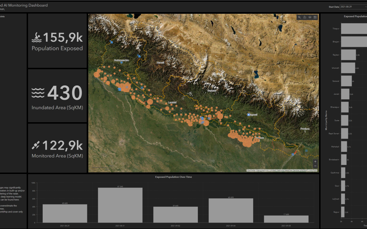
UNOSAT S-1 FloodAI Monitoring Dashboard
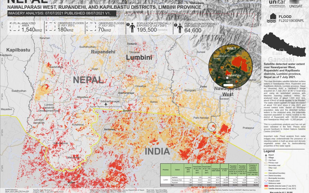
Nepal, being very prone to monsoon-related hazards, has a humanitarian Cluster System in place, under the leadership of the government, and supported by humanitarian organizations in-country to coordinate preparedness and response activities. Each year, an Emergency Response Plan is prepared to guide contingency planning, preparedness, and recovery efforts. When the monsoon started this year, Ragindra Man Rajbhandari, Humanitarian Information Management Unit Manager at UNRCO, contacted UNOSAT to complement the existing tools and processes in place. “We needed the eyes from above to monitor the situation, so we can inform the response decision in time and make the humanitarian response more effective”, explains Mr Rajbhandari. User needs focused on the extent of the water and population exposure. With satellite imagery-derived analysis, the team on the ground was able to differentiate between waterlogging and flooding.
To respond to these needs, UNOSAT deployed its FloodAI end-to-end pipeline where Copernicus Sentinel-1 images are automatically downloaded and processed by machine learning algorithms to output flood extent and regularly update operational dashboards. The machine learning behind FloodAI had been trained on past flood activations handled by the team with similar typographical and climate contexts, such as in Myanmar, and was therefore quickly operational for Nepal. Once the areas of interest and monitoring period were defined in coordination with UNRCO, the model was set to provide daily updates, according to the availability of new Copernicus Sentienl-1 satellite images. Once the AI-generated flood extent was received by the UNOSAT Rapid Mapping team, they were reviewed and corrected as necessary**, and then fed into the dashboard for easy visualization by the end user.
In addition to this dashboard, traditional products such as maps and damage assessment reports, using the results from the machine learning model and verified by UNOSAT’s experienced analysts, were also individually delivered. This allowed the user to slowly adapt their work process and provide feedback on the data collected from the dashboard.
A one-stop shop
To make the information easily digestible for the user, features were tailored to their needs. For example, since the team in-country required estimated figures for population exposure by administrative level, when the dashboard for the following activation was created, a new feature was introduced to visualize that data. The user was then able to not only visualize the number of potentially exposed people on the dashboard in an interactive manner but also download the data in the format best suited to include in their reporting.
Another additional tailor-made feature was the integration of UN ASIGN. Because of a national lockdown, movements were limited, as was the collection of ground information. UN ASIGN was integrated as a way to collect and centralize ground data. The application was shared with field officers across the country to upload geotagged information and photos in real time. The visualization of all the data on the same platform provided a comprehensive overview of the area of interest despite movement restrictions.
“The UNOSAT FloodAI S-1 Dashboards was a very welcome innovation where the satellite imagery-derived information was integrated with ground information in real time. It helped the decision-maker to understand the situation on the ground so our preparedness and response plan was implemented effectively”, explains Mr. Rajbhandari.
Amplify the impact thanks to user-feedback
Between the two activations, the iterations with users allowed our experts to better understand the specific needs and fine-tune the delivery of products and services to best meet them. Thanks to the integration of the AI model, the user received daily updates on the situation, and UNOSAT experts had more time to focus on improvements. In the end, the UNOSAT FloodAI S-1 dashboard became a user-friendly one-stop-shop for geospatial and ground information to inform decision-making in real time.
“During the early phase of the second activation, we used the information from the UNOSAT S-1 FloodAI dashboard to support the National Disaster Risk Reduction and Management Authority (NDRRMA), present a comprehensive understanding of the situation and show exposed population. It helped realize the scale of the event and assess the resources available and the possible response. As a result, the local government was able to take on the response effort, with no need for support from international organizations”.
Mr Rajbhandari expressed his appreciation for the quality of service provided by the UNOSAT team, as well as its responsiveness. This positive experience will be shared with other regional offices, especially in South-East Asia, where the monsoon regularly provokes devastating floods. He also expressed his enthusiasm for the development of similar AI-based tools for other hazards, such as earthquakes. To learn more about ongoing AI research at UNOSAT, please visit www.unosat.org, and follow us on Twitter, facebook and LinkedIn.
** Over the two activation periods, only 17 images had to be corrected out of the 75 processed and validated.


