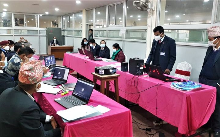
23 December 2020, Geneva, Switzerland - UNOSAT delivered a 4-day training in Kathmandu, Nepal, on the Application of Geospatial Information Technology (GIT) for Disaster Risk Management (DRM) and Decision Support to different Nepalese ministries, police, and army officials. This training was prepared and delivered in collaboration with the United Nations Resident Coordinator’s Office (UNRCO) in Nepal and the Nepalese National Disaster Risk Reduction and Management Authority (NDRRMA).
Starting on Monday 7 December, participants from the Ministry of Home Affairs, Ministry of Internal Affairs and Law, the Army, and the Police forces of Nepal were hosted at the NDRRMA offices to receive a 4-day training on GIT applications for DRM and Decision Support. The group ranged from selected officials contributing to the decision-making processes of their institutions to practitioners, involved in the day-to-day disaster management activities.
The main aim of this training was to develop capacity in GIT and geospatial methodologies for risk assessment and to highlight the impact of scientific evidence on decision making in Disaster Risk Reduction (DRR). The sessions were divided into 4 modules, introducing basic principles of Geographic Information Systems (GIS) and DRR, as well as Remote Sensing, and their application for Emergency Response and Hazard and Risk Assessment. Once the participants acquired this theoretical understanding, they were introduced to the GIS software ArcGIS and challenged to solve DRR problems by developing decision support products. The practical session also focused on gathering free and open geospatial data, using for example the Sentinel Hub EO Browser. Upon completion of the training, participants received a 1 Year software license grant to continue developing their capacities using GIT and satellite derived products to reinforce the DRM of the country.
As an introduction to GIT for DRM, this training was well received by the participants. Not only they found some insights into how the use of GIT could efficiently support decision-making, they were also able to strengthen their own skills. This week of activities was a first step to developing stronger capacities in the country and there is high interest in further training both at the national and provincial levels.
“This is the first training of its kind, and I am glad it is happening in the first year of our establishment. Based on the discussions, what I see is subsequent training on GIS and decision-making, Remote Sensing and Earth Observation. These are tools that are highly useful for high-risk settings such as in Nepal. […] We really look forward to working more with UNITAR, the UNRC office, and other agencies here in Nepal to help build capacities further.” Mr. Anil Pokhrel, NDRRMA Chief Executive
In the context of the COVID-19 pandemic, the traditional in-person delivery methods had to be adapted. Our training experts opted for a blended format, where they connected remotely to deliver each session, and a local facilitator was in the room to provide support and interpretation. The participants also had the option to connect remotely. Using this format allowed an efficient knowledge transfer and high interactivity among the participants without compromising the quality or safety of training delivery.
“It’s pretty amazing to see that something we would never have thought of doing 9 months ago, a virtual GIS training, is now possible. I have been with the UN system for 10 years, and I am very happy to see we can pull something like this off.” – Stine Heiselberg, UNRC Nepal
This activity was delivered under UNITAR’s Strategic Framework Fund, thanks to the support of the Swedish International Development Cooperation Agency (SIDA). For more information, contact us at unosat@unitar.org.


