United Nations Satellite Centre (UNOSAT)
The United Nations Satellite Centre (UNOSAT), part of UNITAR, delivers satellite analysis, training, and capacity development to UN entities and Member States. We leverage geospatial technologies to support humanitarian response, sustainable development, and resilience building worldwide. Through satellite analysis and targeted training initiatives, UNOSAT empowers UN entities and Member States to leverage geospatial technologies for evidence-based decision making. The project “Strengthening Capacities in the Use of Geospatial Information for Improved Resilience in Asia-Pacific and Africa”, implemented between 2021-2024 with funding from the Norwegian Agency for Development Cooperation (NORAD), supported eight countries across Asia-Pacific and Africa in strengthening their geospatial capabilities to address development challenges. The following case study from Bhutan demonstrates the transformative impact of this initiative.
From Training to Transformation: Building Bhutan's Geospatial Capabilities for Evidence-Based Land Management
Bhutan, the world's first carbon-negative country, faces the complex challenge of managing its limited land resources. With only 7 per cent of land being arable, increasing urbanization and development create mounting pressure on food security, climate resilience, biodiversity, and environmental wellbeing. The country's constitution mandates maintaining at least 60 per cent forest cover, requiring careful balance between development needs and environmental preservation.
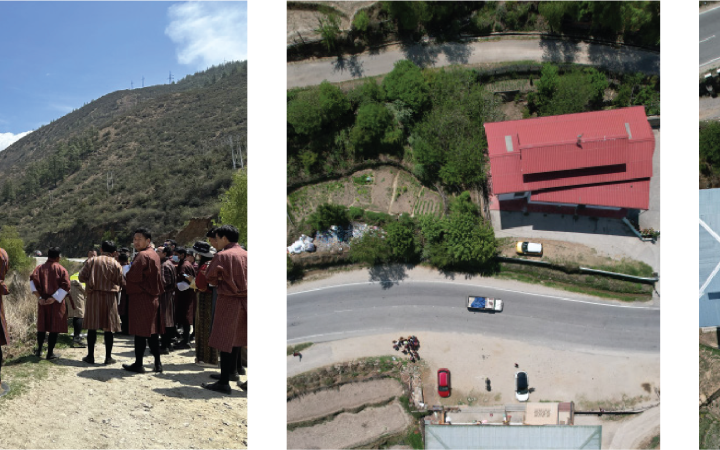
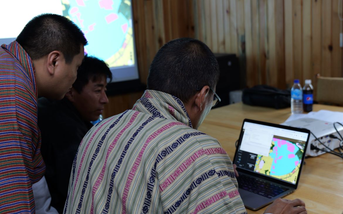
UNOSAT's capacity development activities in Bhutan have strengthened geospatial capabilities across multiple government agencies, including the National Land Commission Secretariat (NLCS)’s, the Thimphu Municipality, Department of Energy, Department of Forestry, Ministry of Agriculture, and the Royal University of Bhutan. Activities included technical training on unmanned aerial vehicle (UAV) operations, remote sensing, and geographic information systems (GIS), complemented by technical backstopping support and development of web-based applications. The project aligned with Bhutan's 2018 Geo-information Policy, which aims to enhance data discovery, accessibility, and sharing mechanisms.
Key Achievements in Bhutan (July 2021 - December 2024)
- 6 Training events
- 3 Web applications
- 19% of women + 60 participants
- 100% of participants gained new, relevant, and useful knowledge and skills
- 90% participants applied the knowledge
Major Outcomes: 1. Strengthened land management and planning capacities
The NLCS has transformed its land management operations through enhanced monitoring and decision-making capabilities. The integration of drone data processing has proven particularly valuable given Bhutan's challenging topography.
The GIS training really improved our ability to process cadastral surveys. Now, we can finish what used to take days in just a few hours. This is saving us time and resources.
noted a NLCS official.
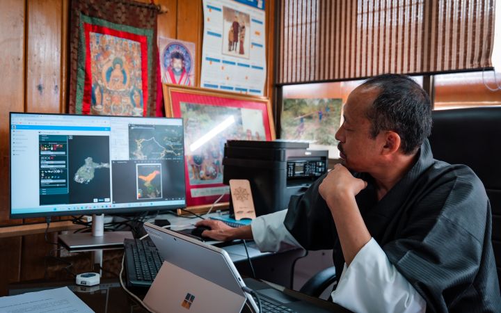
The implementation of web applications, particularly the GeoNode Data Hub, has transformed inter-agency collaboration.
The GeoNode platform allows us to share data seamlessly with other agencies, which wasn't possible before. This directly supports our mandate. This directly supports NLCS' mandate under the Geo-Information Policy.
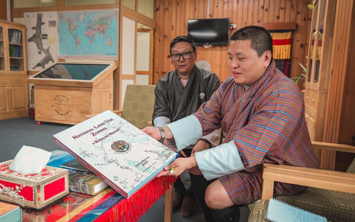
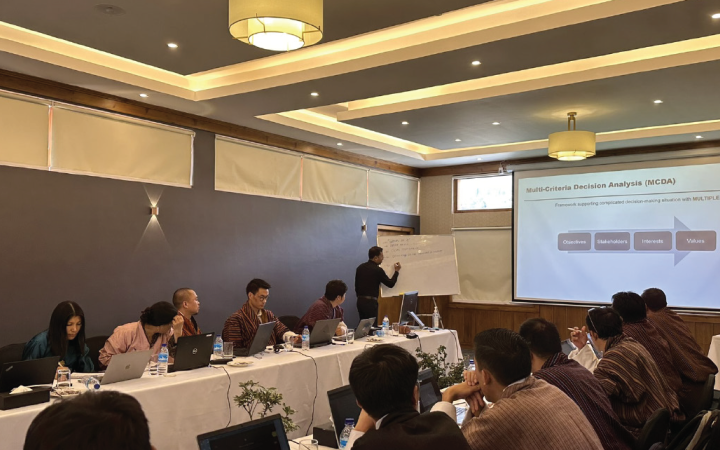
Through the application of the MCDA tool, the Commission successfully digitalized the National Land Use zoning baseline report, enabling evidence-based decisions on conflicting land use preferences.
2. Urban planning in the city of Thimphu
The Thimphu Urban Planning Division has streamlined its zoning processes through GIS tools and web applications. A notable achievement was processing 1,300 street signs into a database within three months, improving postal delivery services.
Moreover, the Division implemented a heat mapping analysis to understand urban heat patterns in the mountain-enclosed capital, where 15 per cent of Bhutan's population resides. Building on earlier UNOSAT capacity development initiatives that set the foundation for this project, GIS capabilities proved crucial during the COVID-19 pandemic emergency response.
GIS helped inform the zones and ensure people had access to supplies within their zones,
explains Mr. Sonam Tobgay, Chief Survey Engineer at the Land Record & Survey Division, who worked in the Incident Command Centre to formulate emergency measures.
The integration of GIS technologies has transformed inter-departmental coordination.
The GIS support allowed us to create layers for urban planning, which improved coordination between departments. We now visualize projects in realtime.
notes Sonam.
His team utilizes open-source web-mapping systems to maintain their spatial database, enabling efficient data sharing across departments and supporting key decisions in road development and urban resilience planning. This practical application has increased not only the speed and efficiency of operations but also enhanced data credibility for evidence-based decision making.
3. Gelephu Mindfulness City planning
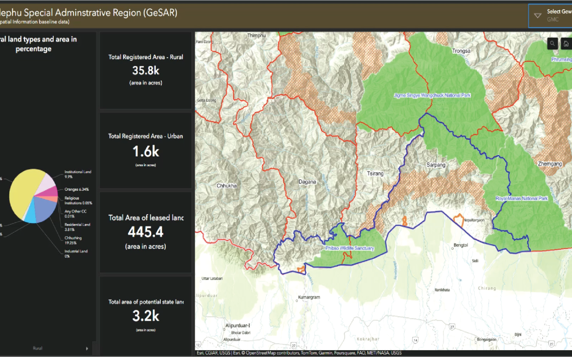
The NLCS has successfully integrated geospatial technologies into its operations, for example, developing an interactive GIS dashboard for the Gelephu Mindfulness City project and implementing standardized procedures for UAV surveys. Mr. Chokila, Superintendent Survey Engineer at NLCS, whose journey exemplifies the impact of UNOSAT's capacity development efforts, is leading this transformation.
Through UNOSAT's training programmes in UAV data collection, Cloud GIS, and advanced remote sensing, Chokila has spearheaded the development of an interactive GIS dashboard for the project.
UNOSAT's training programmes were pivotal in expanding my technical repertoire and acquainting me with advanced tools in geospatial technology,
he explains.
The implementation of UAV technology has transformed traditional surveying practices.
The UAV data collection and mapping training provided by UNOSAT empowered us to modernize our traditional surveying techniques,
Chokila notes.
His department's adoption of open-source drone mapping software has provided a cost-effective solution while optimizing data processing.
The Gelephu Mindfulness City project, covering 2.5 per cent of the country along Bhutan's southern border with India, demonstrates the integration of these capabilities. As one official noted,
Our department has developed the dashboards whereby the interactive dashboards in the ArcGIS Enterprise platform are helping in decision-making for the Gelephu Mindfulness City Project.
4. Established institutional capacity and collaboration between institutions
The project has encouraged inter-agency collaboration, breaking down traditional silos through NLCS' establishment of a coordinated geospatial community. This extends to academia, with insights from the training being incorporated into Royal University of Bhutan courses in geoinformatics. The creation of dedicated training facilities and sharing of ArcGIS licenses between institutions demonstrates the sustainable institutional changes achieved as a result of the collaboration.
5. Environment and Forestry Applications
UNOSAT's support has enabled significant environmental sector advances:
- Department of Energy: Application of MCDA tool for optimal solar photovoltaic site selection.
We relied heavily on the MCDA tool for the solar project. It helped us quickly assess different sites and rank them based on multiple factors.
- Department of Forestry: Implementation of combined drone and GIS capabilities for planning national parks and developing eco-trails.
- Department of Water utilizing GIS for watershed delineation and agricultural planning.
- Ministry of Agriculture: Started developing a soil and crop suitability dashboard.
I'm trying to develop a dynamic map for the suitability of crops in our country... putting in the key factors for landslide areas and generating a possible area after analysis to countermeasure those problems before they arise.
6. Gender inclusion
The project has made meaningful progress in advancing women's participation in geospatial technology. Female professionals from NLCS have successfully applied GIT skills in land use planning and cadastral work, while also taking on training roles.
Being part of this project as a woman in tech has been empowering. It's encouraging to see more female representation in geospatial technology,
notes one participant.
While the current participation rate of 19 percent women reflects ongoing challenges in the technical geospatial field, the project's targeted capacity development initiatives have established a foundation for increasing women's participation in Bhutan's geospatial sector.
LOOKING FORWARD
Through this integrated approach to capacity development, combining technical training, institutional support, and practical applications development, UNOSAT has supported Bhutan in establishing sustainable capabilities for using geospatial technologies in land management and planning. Building on this, NLCS and partner institutions are well-positioned to expand their use of GIT for evidence-based decision making in land management and planning. This success initiative underscores the value of continued international support in strengthening national capacities for sustainable development through geospatial technologies.
References
- United Nations Institute for Training and Research (2024). Endline Evaluation of the Strengthening Capacities in the Use of Geospatial Information for Improved Resilience in Asia Pacific and Africa Project. Retrieved from: https://unitar.org/sites/default/files/media/file/ NORAD_Endline_EvaluationReport_final%20report.pdf
- Royal Government of Bhutan (2023). National Land Use Zoning. A Baseline Report. Retrieved from: nlcs.gov.bt/wp-content/uploads/NLUZ_BaselineReport_2023.pdf
- National Land Commission Royal Government of Bhutan (2018). Geo-Information Policy 2018. Retrieved from: Geo-Information Policy 2018. Retrieved from: https://web.nlcs.gov.bt/wp-content/uploads/2023/12/GI_Policy.pdf
- United Nations Institute for Training and Research. UNOSAT - Geospatial Information Technology for Evidence-Based Decision Making. Retrieved from: https://unitar.org/about/news-stories/stories/unosat-geospatialinformation- technology-evidence-based-decision-making
- United Nations Institute for Training and Research. Chokila's Impact: Leading Geospatial Advancements in Bhutan. Retrieved from https://unitar.org/about/news-stories/stories/chokilas-impact-leadinggeospatial-advancements-bhutan


