Background
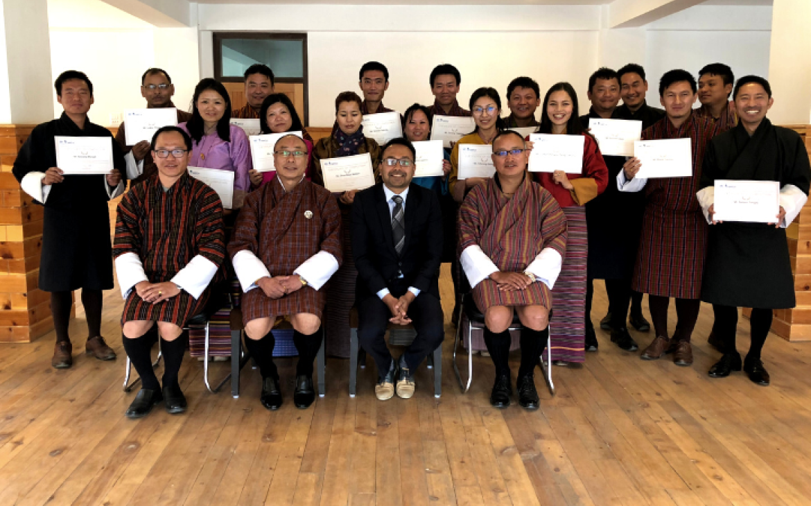
The UNITAR Operational Satellite Training Programme (UNOSAT) contributes to human security, peace and socio-economic development by providing integrated satellite-based solutions for governments as well as relief and development organizations within and outside the UN system. As part of its capacity development activities, a two-week training programme took place in Bhutan, with support from the State of Qatar. With funding through the newly-established Strategic Framework Fund, the programme aimed to enhance the use of geospatial technologies for evidence-based decision making at the national level. This in-country training was organised in cooperation with the National Land Commission (NLC) Secretariat of the Royal Government Bhutan, an institution that was only created in 2008. It brought together government officials from the Ministry of Information and Communications, Ministry of Agriculture and Forests (specifically the NLC), and Ministry of Economic Affairs.
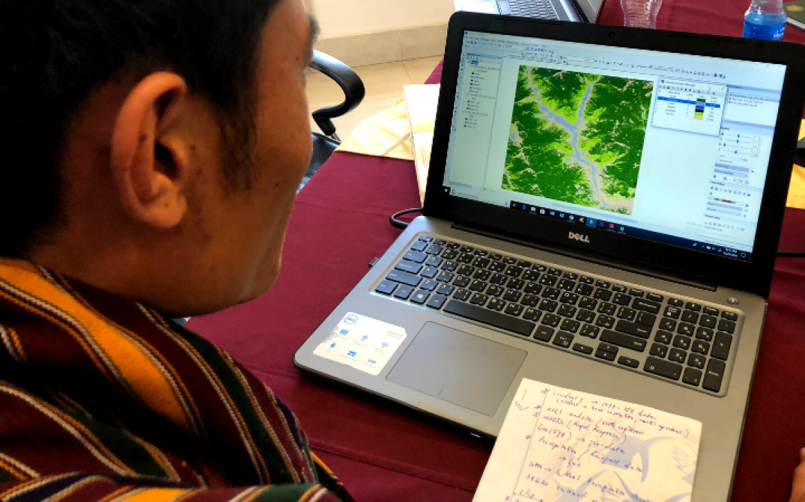
The training developed knowledge and skills on applications of Geospatial Information Technology (GIT) and its operational use in various domains: land-use, urban planning, forestry, environmental monitoring, hazard mapping and disaster risk reduction. The GIT lab exercises using datasets and real case scenarios (e.g. finding the optimal location for a new hospital in Thimphu using multi-criteria evaluation) helped participants practice and apply what they learned from theoretical lectures. For a longer-lasting impact of the learning experience, UNOSAT set up an online community of practice where participants can request technical support during and even after the training. There are also plans to monitor performance improvement of participants together with the NLC to support knowledge retention and to establish ad-hoc live web map platforms that participants can benefit from when they carry out the national projects.
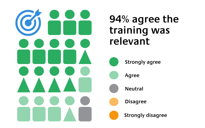
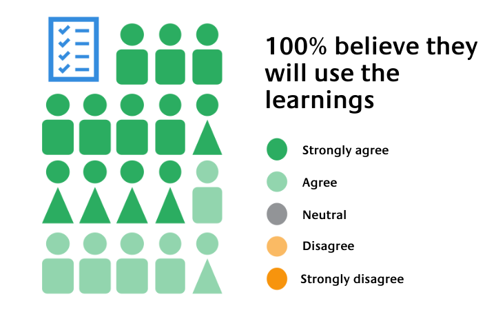
In an evaluation conducted immediately after the training, all but one participant agreed that the content of the session was relevant to their work (figure 1). Additionally, all agreed that they will use the information acquired in their work (figure 2). When this information is taken and combined with the experiences of Sonam and Pema since the training, the focus of this impact story, we can begin to get a picture of the impact that this training has had, and hopefully will continue to have in the future.
Impact Story - Sonam Tobgay
Mr. Sonam Tobgay
Chief Survey Engineer / Land Record & Survey Division
Thimphu Thromde
Sonam is a hardcore GIS user and expert surveyor from Bhutan. He has been working with the National Land Commission Secretariat (NLCS) for thirteen years and works at Thimphu Thromde (Municipality Office) in close collaboration with the NLCS. Currently, he heads the Land Record and Survey Division.
When speaking to him it feels like talking to a GIS ambassador who strives to strengthen GIS evidence-based decision making in land management in Bhutan. It is obvious how passionate he is about his work; he is engaging, enthusiastic and knowledgeable. It is also clear that, for Sonam and his team, the several UNOSAT training have had an important impact on the work that they do.
While inspiring this feeling, Sonam recalled his participation in the first UNITAR training in 2018, which was related to basic GIS knowledge. At that time, he worked outside in the green forests of Bhutan collecting data and maintaining the National Spatial Data Infrastructure (NSDI) in Bhutan.
For at least five years before the first training, he worked to collect data and maintain the national spatial data infrastructure (NSDI) in Bhutan, and through his work, he found out about the UNOSAT training. At that time, there were two projects that he focused on. The first one was the topographical base map preparation for the entire country. On a scale of 1:25000, this dataset forms the core of Bhutan’s NSDI. The National Cadastral Re-Survey Programme was the second project he was working on with a team of 80 people (20 surveyors). He informed us that these two projects contributed towards developing a comprehensive repository for NSDI and eventually informed the National Land Use Zoning (NLUZ) project. This is particularly important in Bhutan, where approximately 70 per cent of the land is tree-covered while arable land is only about seven per cent. The zoning project, planned for 2017-2023, aimed at ensuring nationwide spatial integration and establishing coherent zoning ordinances to facilitate and boost the Smart Growth of the country, without undermining the carrying capacity of the land and its environment (NLCS, 2018). With both projects, the learning impact of the UNOSAT training can be seen.
Besides the above, there were two very practical and specific examples of how he immediately put the knowledge of the first GIS training into practice. After the training ended, he performed a spatial analysis that determined the average slope of a parcel of surveyed land. He reported that as per the country's laws, generally, land with a gradient of more than 45 degrees is not used for agriculture and construction purposes. Having this criterion as a background, he used the learned techniques from the training to design an analysis that calculated the average slope of a certain region. Afterwards, by overlaying with the data that was being surveyed in the field, he could crosscheck what the average slope was, allowing for better performance thanks to more robust analysis and greater data reliability. These were all techniques and knowledge that he acquired from the training, which aligned clearly with UNITAR’s objective of strengthening evidence-based decision-making.
Sonam indicates that in 2018, there were approximately 20 data collectors in the field working under his supervision on the National Cadastral Resurvey Programme measuring thousands of land parcels. In the past, it was challenging to reach these collectors due to the remote locations they often operated in, making it difficult to coordinate their work. The first course introduced an app called Epicollect5, which Sonam shared with his colleagues and has since been used to monitor and crosscheck data collected in the field for its friendly and easy-to-use interface. He can quickly see who is doing what and where, receiving information, videos and pictures daily. All of this can be visualized using the app, allowing him to track data in near real-time, thereby making more efficient and effective use of time and resources. He continues to use the app today to manage various field projects in the municipalities of Phuentsholing and Thimphu. Additionally, a customized version of the app was developed by the National Land Commission to conduct the pasture survey for Bhutan's highland communities. Sonam credited the culture of curiosity that exists within his department, and in Bhutan in general, for the success in implementing these new ideas and tools. There is a tangible excitement about the potential that GIT offers.
We had again the chance to speak to Sonam years after the first meeting. Sonam has since taken part in many other online and face-to-face training from UNITAR, such as the “Advanced Training on UAV Data Collection, Processing, and Mapping “, “Advanced Remote Sensing for Sustainable Land Management”, “Foundational Course on GIT for Sustainable Land Management” and those related to the GIS app development, under the NORAD-funded project “Strengthening capacities in the use of geospatial information for improved resilience in Asia-Pacific and Africa”. The different training focused on the use of GIT in evidence-based decision-making. This is something that Sonam and NCLS strive to integrate, and the training events have provided the tools and necessary know-how to support the implementation of such an objective.
The practical application of knowledge gained during the different training has increased the quality, speed and efficiency of Sonam’s work, but more importantly for Sonam, the data that his department now collects has more credibility and helps to solve problems. In this regard, he told us about a crucial moment of GIS during the COVID-19 first lockdown when he worked in the Incident Command Centre (ICC) of the Capital City to formulate the emergency response. “It was challenging to have authentic data and that’s where GIS came into play. GIS helped inform the zones and to ensure that people had access to supplies within their zones” given that mobilization among zones was restricted. This was for Sonam a crucial moment, illustrating that decisions were based on data instead of hearsay. As part of this process, Sonam and his team, using GIS tools, developed a zoning system for Thimphu to facilitate resource mobilization and implement COVID protocols.
With the training events, Sonam and his team have more sources of data, meaning they are not only dependent on data from the surveyor, as field data was not always reliable. Using multiple sources of data and data analysis combined with data from Epicollect5 and the GIS platform that they are currently using, they can perform cross-validation. Data authenticity was the main concern for accomplishing his tasks and the training has helped in this regard, resulting in better use of data, better quality of reports and more confidence in the information they are presenting. One of his current tasks comprises the implementation of the new Thimphu Structural Plan.
Before the first training, Sonam had limited experience in the use of GIT, although one gets the impression, he is very humble when discussing his expertise. Learning about the various functions and tools of software like ArcGIS and UAV was one part of the training events. For Sonam, of equal or perhaps even greater importance than the tools and the types of data one can collect, is how one uses the data. This more theoretical aspect, of new ways of thinking about the use of data, was of most value for Sonam, expanding his understanding of what is possible. It will perhaps have the longest and most far-reaching impact. “You give a man a fish to eat, and he survives a day, you teach a man to fish, and he survives,” said Sonam to express the impact of the received training on his work.
Sonam is excited about the future, and the continuing impact that the training will have. He expects to have the opportunity to participate in more specific training that addresses particular and practical user cases to “think globally but work locally”, as expressed by Sonam. This training has created advocates for evidence-based decision-making in Bhutan. The true impact of this will hopefully be both long-lasting and far-reaching.
Impact Story - Pema Zangmo
Pema Zangmo
Survey Engineer with the National Land Commission Bhutan
Draws inspiration from the training
The potential for future impact can be seen with Pema, another participant of the UNOSAT training. Only two years into her job with the National Land Commission as a survey engineer, Pema has a different scope of work than Sonam. Nevertheless, the training has already had some impact, with Pema raising the use of the Epicollect5 tool in meetings, with plans to explore the use of the app further with her colleagues. They have already used it to carry out surveys and field work. She has also carried out a project to collect information on plot and building details for a local project using the app. She is a member of a taskforce that is carrying out a sustainability assessment for the construction of a power plant in 2040, using a weighted index method and multi-criteria decision analysis (MCDA). In the quarterly taskforce meetings Pema attended before the training, she at times felt she was slightly lost and found it hard to follow some of the discussions. Equipped with knowledge from the training, in the latest meeting she could follow the MCDA, understand the uses of GIT and could contribute in a meaningful way. This may not be a broader impact, but for her confidence and potential for advancement in her career, it is profound. The most exciting impact of the training is still to come. She has plans to write a paper on the use of GIT, linked with her bachelor thesis on urban planning and spatial transformation. She says she has been inspired by this course. Again, the impact that is most clearly visible stems from fostering people with a passionate understanding of the importance of evidence-based decision making, in jobs where they can make a real difference, equipped with the tools necessary to do so.
A plan to follow up with Pema and Sonam in 6 months’ time has already been set, to see if and how they have continued to use what they have learned thanks to this course. Touching base with them again will allow us to follow them on their journey as this training hopefully continues to have an impact with them further down the road. This will include a discussion on the monitoring of performance with NLC supervisors, as envisioned in the project document. The NLC sent 15 participants to this training, and if the impact is similar for these participants as it has been for Sonam and Pema, then evidence-based decision making will be integrated into the NLC for some time to come.
Conclusion
The Impact Stories were written just four weeks after the training ended. At first, we were concerned about being able to measure the impact so soon after the event. Although we couldn't yet measure the wider impact of the course, speaking with Sonam and Pema made it clear that the impact has been immediate in some ways. Sonam confirmed that the training has changed how he works, improving efficiency and data reliability. More importantly, it has allowed them to think about data differently, providing them with a new perspective. Integrating the use of data for evidence-based decision-making will have a profound impact on Sonam and Pema's work and, by extension, the NLCS. If they do so, and the evidence suggests they are up to the task, this will help contribute to the SDGs and benefit their institution and Bhutan in whatever small way.
GIT and how it contributes to the SDGs
Over the past two decades, Geo-spatial Information Technology has rapidly developed and is now being called an “enabling technology” due to the benefit it offers across different application domains. GIT can help analyse and better understand why and where things have happened in the past. By extension, it can also show us why and where something might happen in the future, allowing for more informed decision-making and better use of resources.
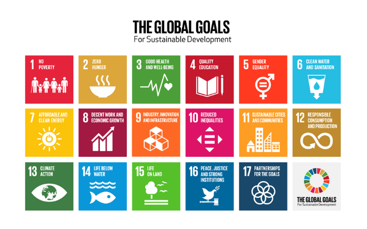
GIT applications and their use for evidence-based decision making can contribute to the implementation of the Sustainable Development Goals (SDGs). The clearest link that can be made with this training is with SDG 9: Industry, Innovation and Infrastructure and SDG 11: Sustainable Cities and Communities. It may also have knock-on effects to several others, due to the interrelated nature of the goals. For example, one of the projects discussed above relates to the construction of a new power plant in Bhutan, and is therefore linked with SDG 7: Affordable and Clean Energy. Sustainable use of land also potentially has an impact on SDGs 6, 8, 13, and 15. The link with SDG 13: Climate Action, is particularly pertinent to Bhutan, the world’s only carbon-negative country – it takes more carbon out of the atmosphere than it puts in. Ensuring this continues to be the case, through sustainable land management, allows Bhutan to be a guide for the rest of us. Finally, there is a hope that this will be the start of a joint venture between UNOSAT, the National Land Commission, and other agencies in Bhutan, thus contributing to SDG 17: Partnerships for the Goals.
UNITAR is grateful to the State of Qatar for its contribution to the Strategic Framework Fund. The Strategic Framework Fund is a facility to support the implementation of the UNITAR 2018-2021 Strategic Framework and to help UNITAR contribute to the achievement of the Sustainable Development Goals. Emphasis is placed on helping countries in special situations achieve the Goals, including the least-developed countries, the landlocked developing countries and the small island States.
References
National Land Commission Secretariat (2023). National Land Use Zoning - A baseline report. N. L. Commission. Thimphu, Bhutan, National Land Commission Secretariat. https://www.nlcs.gov.bt/wp-content/uploads/NLUZ_BaselineReport_2023.pdf


