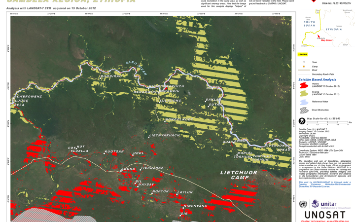
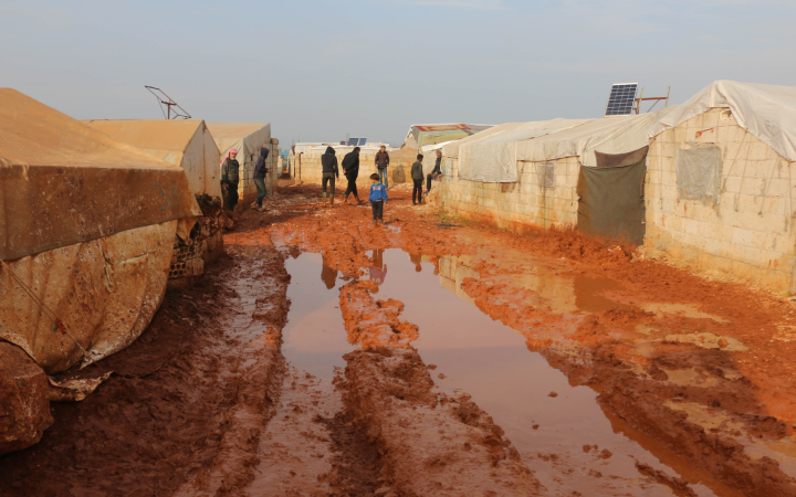
In 2014, heavy rains flooded the Leitchour refugee camp, in the Gambella region of Ethiopia. In advance of the rainy season, UNHCR called upon the support of UNOSAT to access satellite imagery and support with flood analysis in order to assess the damages. Since then, satellite imagery-derived disaster risk analysis was systematically included in the site assessment process for all emerging crises. John Wain, Senior Emergency Shelter Officer at the United Nations High Commissioner for Refugees (UNHCR), recalled the evolution of their work and how UNOSAT supported them with satellite imagery analysis to better plan for new settlements.
“Geospatial and hydrological data as well as analysis is essential. It is a primary step when establishing settlement. Data analysis informs the very first step in settlement planning.”
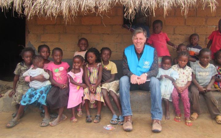
John Wain is part of the Division for Resilience and Solution’s Technical Support Section at UNHCR. His role, in the context of population displacement, includes surge capacity for Refugee and Internally Displaced People (IDP) emergency responses. He also accompanies the first phases of emergency response while other teams get up to strength with more mid-term solutions. A lot of that from a refugee context is settlement planning: new arrivals and large influx of refugees needing to find a solution from various types of settlements. John Wain explains how Earth Observation (EO) and remote sensing supports the first phase of settlement planning: “What is informing a site plan is a map and the first step for that is assessment site, satellite imagery, topographical surveys, hazard risk analysis. We have built up a rapport with UNOSAT for getting rapid satellite imagery and site analysis to enable site planning to start”.
Building climate resilience
Products such as hydrological analysis, landcover, and elevation maps can be derived from satellite imagery. They are essential in the preliminary phase of settlement planning to determine whether a location is prone to a specific hazard and also support the development of timely hazard mitigation plans. Questions like drainage are also key to best develop and equip the camp. Mr. Wain explains how “this heavily relies on the use of satellite imagery, remote topographical sensing and various settlement analysis activities” which they counted on the support of UNOSAT for.
Because of the threat that Climate Change poses, greater climate resilience is needed and for that, the assessment must go further. “Adapting to climate change is extremely high on the radar at the moment. From a settlement planning perspective, the number one strategic goal is hazard risk analysis”. An increasing number of environmental impact assessments are conducted to identify and prioritize best environmental practices from the start. More comprehensive, these assessments include for example the expected impact on resources, waste generation and pollution, and potential changes in the environment due to the creation of large settlements. Mr. Wain says “it will become the norm for sure, and there is again huge reliance on satellite imagery and analysis to support that”.
The Master Plan
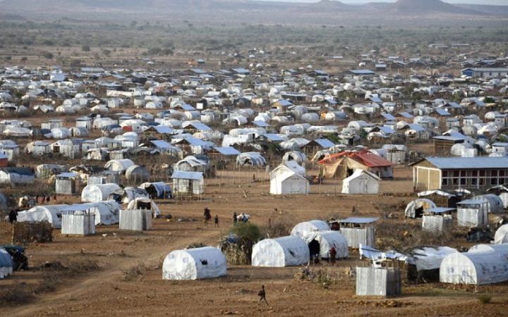
Large settlements have an estimated average lifespan of 17 years. Semi-permanent structures and infrastructure in these settlements need to resist climate challenges so that the displaced population can integrate the host community in a safe and sustainable manner... For that, UNHCR has developed a Master Plan Approach to Settlement Planning. The idea behind this approach is simply that refugee settlements should not only benefit the displaced but also the host community. Therefore, to stand alone settlements with all-inclusive services such as medical centers and schools, are preferred settlements that blend in the existing urban context. Mr. Wain explains that for this master planning, satellite imagery and mapping are used to assess the proximity of the selected site to villages, towns, national infrastructure, to ensure proper planning and foster integration. This way, the significant multi-sectoral infrastructure investment does not only benefit the refugees but also the host community*.
UNHCR and UNOSAT
“There are others who provide these geospatial services and new partnerships emerging, but thanks to our global agreement with UNITAR, our go-to agency has been UNOSAT for this particular type of support.”
In 2019 a global agreement was signed between UNHCR and UNITAR, consolidating and expanding from a previous agreement signed in 2011. In practice, these agreements guarantee UNHCR access to the latest products and services implemented by UNOSAT for human rights mapping. As a result, Mr. Wain and his team were able to quickly receive from UNOSAT the images and data needed. In support of the TSS multi-sectoral team, UNOSAT provided various images and types of analysis for 23 refugee settlements in 13 countries. From hydrological data for flood hazard analysis to landcover analysis and elevation maps to know the typography of the location, all these are critical for site planning and supported the process in each of the 23 locations. This agreement also allowed to save time and resources otherwise spent on the question of cost for sometimes very expensive satellite imagery, says John Wain.
“The collaboration with entities like UNOSAT for hazard mitigation is a huge opportunity and something we need to strengthen going forward”.
To illustrate the collaboration between UNOSAT and his team, John Wain mentions the situation in the Sudanese-Ethiopian border with the large number of refugees escaping since November 2020 the conflict in Tigray, Ethiopia, and arriving in Sudan. To relocate them, the government had selected a site that was potentially concerning, but the information necessary for a flood risk assessment was scarce. Mr. Wain contacted UNOSAT to support with satellite imagery derived flood analysis, to assess whether the location was prone to flood. Quickly, it was established that it indeed was, which prompted UNHCR to introduce a mitigation plan and make sure that the refugees were protected from potential climate-related hazards.
As was the case in Tigray, Mr Wain highlights that the lack of data is a common challenge for national and regional emergency management authorities. Therefore, satellite-derived products received by UNHCR on the ground can be shared with local authorities. However, an even bigger and common challenge John Wain experiences is the lack of capacity to access and use the data. Indeed, many of the technical officers in the field do not have the resources or training to open, process, and digest the information. As a bridge between Geneva and the field, he provided feedback and efforts were made to share the data in formats that are accessible. Nonetheless, a considerable need for training remains for local authorities, and to make geospatial technology and data more user-friendly and accessible.
COVID-19: re-thinking settlement planning and expansion
Responding to the COVID-19 pandemic has also accelerated the demand for real time geo-spatial imagery support. Once the World Health Organization (WHO) declared an international public-health emergency, UNHCR had to address the issue of density in refugee settlements to make safe distancing possible. “Often times there is a very high density in refugee settlements, we were quite concerned about that. So, we developed a checklist and a case study for the colleagues in the field to support them addressing the density issue.”
The checklist considers actions to address identified COVID-19 risks and ascertain what actions could be undertaken to reduce density where it is determined to be excessive at household or settlement level, or both. The list also helps identifying health infrastructure needs so that the overall spatial planning approach and any additional land requirements are taken into account. Satellite imagery is again of great support for assessing the needs and possible solutions.
The years of collaboration with UNOSAT have given John Wain a positive outlook on the possibilities of using Geospatial Information Technologies (GIT), not only for settlement planning but for humanitarian work in general. He mentions his wishes for UNOSAT to become an even larger service provider and become the reference for satellite imagery and analysis in support of UN and humanitarian work.
To know more about UNHCR’s work with settlement planning, please visit this website.
For updates on our collaboration, follow us on Twitter, facebook and LinkedIn.
*This fits within the comprehensive refugee response framework from the New York Declaration for Refugees and Migrants, of which one of the underlying idea is to support hosting governments deal with the refugee influx.


