3 December 2021, Geneva, Switzerland - The ambitious agenda of COP 26 to accelerate action towards and beyond the goals of the Paris agreement may have been a let-down for most people. For the United Nations Satellite Centre (UNOSAT), it was also an opportunity to promote once more the added value of satellite-derived information for improving climate resilience.
The conference was “an important step but not enough” in the words of António Guterres, Secretary-General of the United Nations. Despite the negotiations underdelivering, many insightful events took place, where delegations could learn from different ongoing efforts. In this light, COP26 was a unique space for UNOSAT to showcase the considerable benefits of using Geospatial Information Technology (GIT) and earth observation data as a source of objective information to support evidenced-based decision making and access to climate finance.
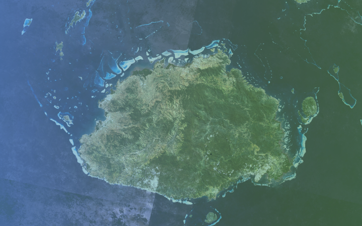
During the second week of the conference, UNOSAT co-hosted two side events in the blue zone. On November 9th under the theme of science and innovation, a facilitated panel discussion was held at the Commonwealth Pavilion on “Leveraging the use of geospatial information technology and satellite data for improved climate resilience and disaster risk management”. This event, co-organized by UNOSAT, the Commonwealth Secretariat and the Government of Fiji, explored the potentials of the CommonSensing (CS) solution and discussed opportunities and challenges of its application and expansion. With nearly a third of the population living on land less than 5m above sea level, Small Islands Developing States (SIDS) are vulnerable to the threat of rising sea levels, degrading their coastlines, threatening communities and their livelihoods. To support the Government of Fiji and other Pacific SIDS facing similar environmental challenges, namely Vanuatu and the Solomon Islands, UNOSAT and the Commonwealth Secretariat joined up for the CS solution with the initial support of the UK Space Agency’s International Partnership Programme (IPP). During the event, UNOSAT’s Director Einar Bjørgo gave insights on how the CS solution can help strengthen informed decision making for disaster risk management and access to climate funds by providing objective and historical evidences. The Technical Platform offering robust data and Climate Finance Country Report, developed as part of the CS solution for Fiji, were showcased for awareness raising and they are expected to be officially launched in the country early next year. With the support of the Norwegian Agency for Development Cooperation (NORAD), not only the existing Pacific partner countries but also other SIDS and LDCs in Asia and Africa regions will further benefit from the CommonSensing in the years ahead.
“The CommonSensing project is a really innovative collaboration […] with Fiji, Solomon Islands and Vanuatu that leverages EO data around disaster and climate risk to inform planning, food security needs and increases access to Climate Finance. […] this is central to this COP” - Rt. Hon. Patricia Scotland, Secretary-General, The Commonwealth Secretariat
“UNITAR is happy to support the Fijian government in developing capacity on the use of earth observation data – and we trust our lessons learned through our engagement in Fiji will further assist other small states facing similar challenges” Nikhil Seth, Assistant Secretary-General, Executive Director
Thanks to the confirmed strong partnerships, the outcomes of the CS project will sustain through time for a long-term impact in the Pacific region, and the solution is readily applicable to other climate-vulnerable countries across the globe. The interest voiced by other Commonwealth Countries to see this replicated, made this event a success.
On November 11th, UNOSAT hosted another side event jointly with UNCDF, UNDRR and UN-Habitat in Strangford Lough under the One UN framework. During the interactive panel discussion on “Enhancing climate resilience for LDCS and SIDS through space data, finance mechanisms and partnerships”, UNOSAT demonstrated the potentials and use cases of practical applications of geospatial technology for enhanced climate resilience.
The significant benefits of using GIT and EO data to efficiently monitor, report and verify situations such as sudden on-set disasters, including the COVID-19 pandemic, as well as crop health and land use changes, were illustrated. The panel speakers agreed on the need for making the EO-based information widely available, digestible and easily accessible. As powerful as a satellite imagery analysis can be when combined with other sources of information, if the local users do not know how to access or process it, the potential would be wasted.
“Decision making needs timely and objective information. It also needs information that decision makers can understand. In the past, the space community has failed in providing this digestible information” Einar Bjørgo, Director, UN Satellite Centre (UNOSAT) - UNITAR
Ensuring the accessibility of such space and ground-level data and making sure both the technical users and decision makers have sufficient capacity to translate them into actionable insights are an area where a lot remains to be done. The recent Global Sustainable Development Report highlighted the significant role of satellite data in enhancing climate resilience especially for small countries and called for more collaborative actions of the UN and stakeholders to make the Member States benefit from quality information and training opportunities.
To stay informed, follow UNOSAT on Twitter, Facebook and LinkedIn.


