UNITAR-UNOSAT’s Geotag-X needs your help!
UNITAR-UNOSAT’s Geotag-X (geotagx.org) is a pilot project of the three year Citizen Cyberlab research project. Geotag-X is a platform for crowdsourcing analysis of the media coming out of a disaster situation. As smartphones with cameras and geo-location capabilities become more accessible, more and more media is being created and loaded onto the internet in a disaster situation. With Geotag-X, we want to find a way of harvesting this media, categorising it, and extracting data that is relevant to the response and relief efforts. We want to go beyond binary questions about what is in a photo, and see if we can teach the crowd to perform detailed analyses of media that would normally require specialist skills and expertise. With this research we are attempting to answer questions such as “How much media comes out of a disaster situation?” “How can we effectively collect and categorise that media?”, “What information is in the media that could be useful to the relief and response effort?”, “How can we extract that information?”, “Can we teach the crowd to perform complex analyses of media using only online tools?”
After lots of hard work developing and refining out test projects we now need your help! Geotag-X is still in beta version but we need volunteers from the general public to go online and start analysing photos for us. The data you produce will be used to assess if this tool is something that could eventually be used operationally in a disaster management context.
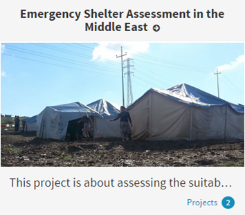
 The first project we are asking for your help on is the “Emergency Shelter Assessment in the Middle East”. This project has been developed in collaboration with the REACH Initiative (http://www.reach-initiative.org) who undertake data collection and analysis in emergency situations to inform the planning and delivery of humanitarian assistance. When people flee disasters, they may spend time in camps, sometimes for many years. Emergency shelters - often tents - need to be protected from harsh climatic extremes in both summer and winter. Weather conditions in the Middle East are characterized by very warm summers and cold winters, with temperatures sometimes dropping below freezing. In winter, heavy rain, snow and high winds can sweep the region, leaving displaced families in camps and informal settlements particularly vulnerable. This project uses criteria developed by the REACH Initiative and the Global Shelter Cluster (http://www.sheltercluster.org/) to assess whether emergency shelters are suitably prepared for winter. You can contribute by answering simple questions about a series of photographs.
The aim of Geotag-X is not only to assess potential new means of data collection, but also to raise awareness of the situation of people caught up in disaster situations. According to Megan Passey from REACH “We hope that the project will introduce a wide audience to observation-based questions, which are one important component of humanitarian assessments. The project uses real questions, used by our data-collectors in the field, to understand whether emergency shelters meet minimum standards and provide adequate protection to those who live there. The use of current examples from Northern Iraq and Jordan illustrates the harsh reality for thousands of displaced people living in formal and informal camps across the region.”
So if you have 15 minutes to spare, head to the “Emergency Shelter Assessment in the Middle East” project to analyse some of the photos. You can also explore some of the other projects still under development and become part of the Geotag-X community by creating an account. If you have any thoughts about how we could improve Geotag-X, or maybe you find a bug, feel free to use the feedback form on the website, or contribute to some of the discussions around individual photos.

