EMERGENCY MAPPING SERVICE OF THE UNITED NATIONS SATELLITE CENTRE (UNOSAT)
The increase in disaster occurrences and the high numbers of victims resulting from conflicts are urgent issues that require effective and rapid action. Satellite imagery analysis is a vital tool essential in this response, as it can cover large areas and provide accurate information in near real-time.
UNOSAT’s Emergency Mapping Service (EMS), funded by the Norwegian Ministry of Foreign Affairs (NMFA), provides satellite image analysis during humanitarian emergencies related to disasters, complex emergencies and conflict situations. With a 24/7 year-round availability to process requests, the team of experienced analysts ensure timely and tailored delivery of satellite imagery-derived maps (both web and static maps), reports and data ready for direct inclusion in Geographic Information Systems (GIS) for evidence-based decision-making and operational planning.
UNOSAT's Critical Role in UNIDO's Gaza Industrial Assessment
Following the escalation of conflict in Gaza, the United Nations Industrial Development Organization (UNIDO) faced significant challenges in assessing damage to industrial and business infrastructure and planning for recovery. Limited ground access and rapidly evolving conditions necessitated reliable, current information for informed decision-making regarding the status of industries. This critical need was met through a collaborative effort with UNOSAT, showcasing the power of inter-agency cooperation within the UN system.
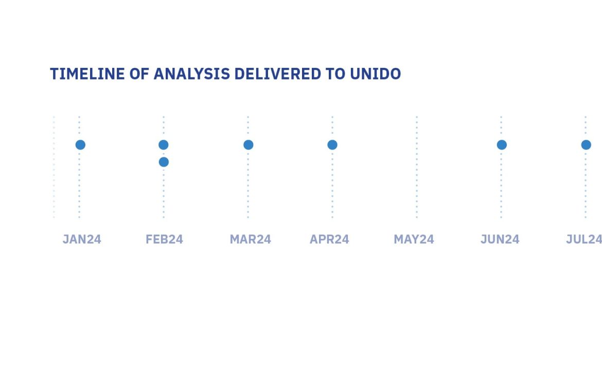
Between January and June 2024, UNOSAT provided UNIDO with seven (7) comprehensive industrial facility damage assessment products. These assessments leveraged high-resolution satellite imagery to analyze an expansive 363 km² area across the Gaza Strip. The resulting web-based maps and detailed reports offered a thorough and up-to-date overview of the industrial landscape in Gaza, forming the foundation for UNIDO's strategic response.
Damage assessment
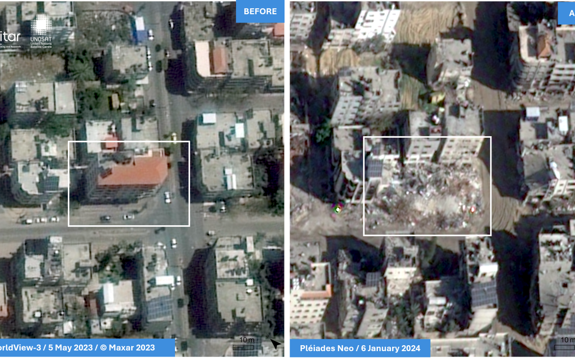
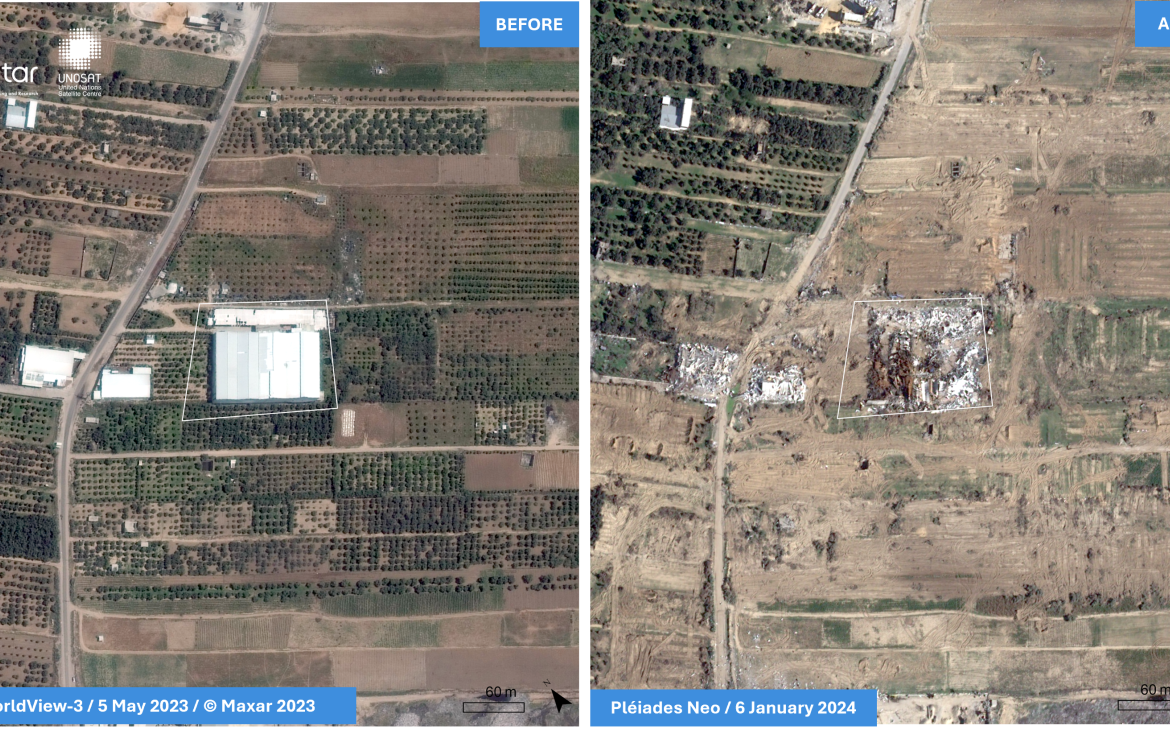
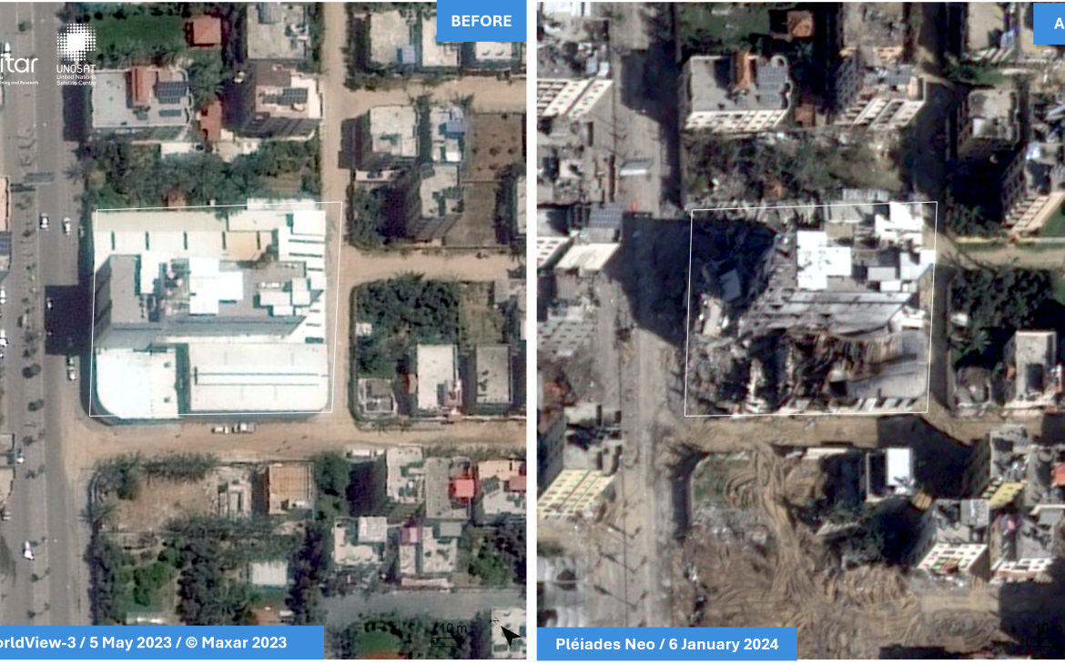
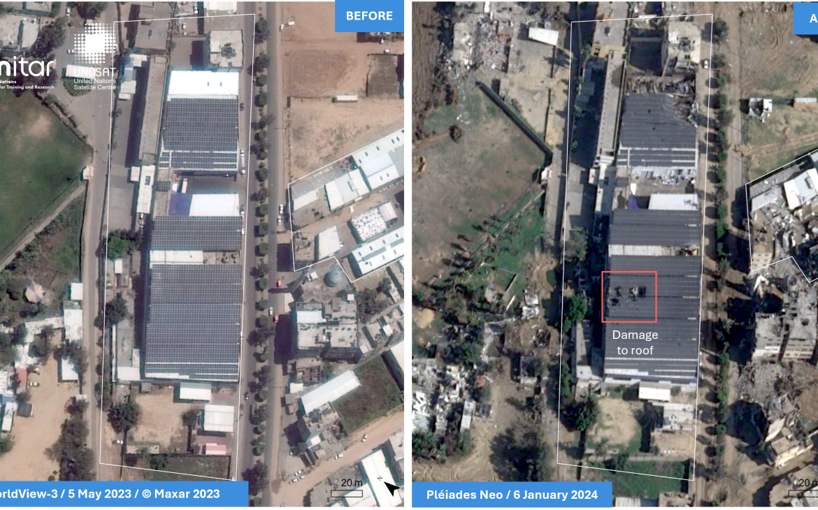
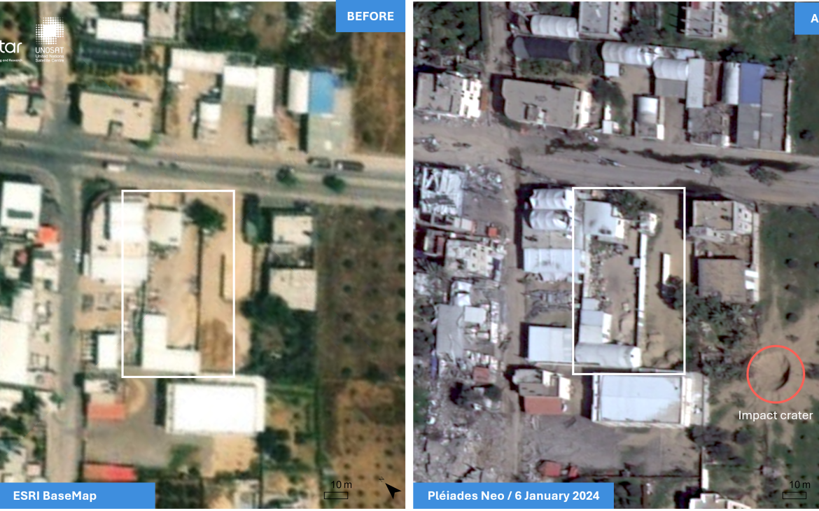
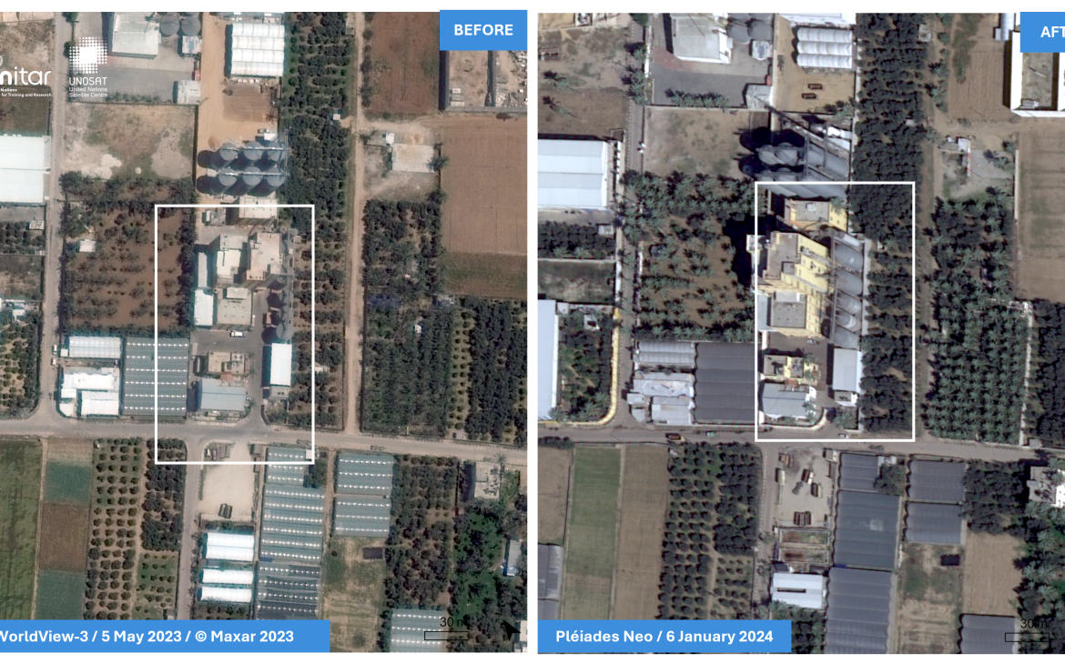
The assessments categorized industrial facilities as destroyed, severely damaged, moderately damaged, possibly damaged, or showing no visible damage. The most recent report identified approximately 73 per cent of industrial and business facilities as damaged,1 with over 15 per cent of buildings classified as destroyed and approximately 5 per cent of buildings showing new or increased damage since the previous assessment.[1]
UNOSAT identified 88 per cent of Gaza’s industrial and business facilities as damaged or destroyed.[2]
[1] Information updated to 15 July 2024.
[2] This includes severely damaged, moderately damaged, and possibly damaged.
TRANSFORMATIVE IMPACT: UNOSAT-UNIDO COLLABORATION IN GAZA'S INDUSTRIAL RECOVERY
UNIDO has used EMS-UNOSAT's products, particularly the industrial and business facilities status updates, for situational awareness and needs assessments in Gaza. These updates have been crucial for understanding the extent of damage to industrial and business sectors, which has informed UNIDO's scenario-building and response planning. Through the partnership and synergies between UNIDO and UNOSAT, achieved the following outcomes:
Enhanced Decision-Making: UNIDO used UNOSAT's analysis to understand the full extent of damage to industrial and business sectors in Gaza. Ahmed ELFARRA, Senior Programme Officer at UNIDO Palestine, stated, "We started understanding that we do need to know how the industry was impacted, how the business community was impacted, who is possibly available to re-engage, when feasible, based on the data that was collected by UNOSAT."
EMS-UNOSAT's products have transformed UNIDO's decision-making process. Previously, they relied on testimonies and limited ground observations due to the context. Now, they have an objective, comprehensive and up-to-date understanding of the situation, allowing for more informed and strategic decisions.
Targeted Resource Allocation: UNOSAT's updates have significantly influenced UNIDO's decision-making by helping them prioritize which industries and facilities might be available for restoration in the early stages of recovery. They have used this information to allocate efforts towards potentially operational facilities (20-30% of the total).
UNOSAT- UNIDO Joint Assessment served as a key information source for the Assessment in Commerce, Industry, Services and Financial Sector, part of the Gaza Strip -Interim Damage Assessment conducted by the World Bank, European Union, and United Nations. This assessment quantifies the conflict’s impact on Gaza in both monetary and physical terms, providing crucial data to guide partners and the international community in their financing and analytical support for Gaza’s complex emergency response and recovery efforts.
- Strategic Recovery Planning: UNOSAT’s damage assessment enabled UNIDO to plan for early recovery efforts, especially for vital industries such as food and pharmaceuticals. ELFARRA explained, "For vital industries such as food and pharmaceutical, we can assess which factories that we can re-engage when the situation allows. This has been regularly utilized to engage with the private sector for identification of the level of interventions needed for these facilities to resume operations under the different scenarios."
Reinforced synergy and coordination during emergency situations: UNOSAT's products have served as a common reference point for coordination among UN agencies and other stakeholders. UNIDO has used this information in discussions with other UN agencies, the European Union, and the World Bank, facilitating a shared understanding of the situation on the ground.
Moreover, the information provided by UNOSAT has also contributed to broader UN initiatives. ELFARRA mentioned that UNIDO took the information provided by the analysis from UNOSAT and managed to use it for a comprehensive analysis of the UN system, particularly in the context of the Secretary-General Security Council Resolution 2720-“Protection of civilians and enabling of immediate humanitarian assistance to Palestine in Gaza”.
- Improved Stakeholder Engagement: UNIDO used UNOSAT's products to engage more effectively with the private sector, both those still in Gaza and those who had left. As ELFARRA noted, "We've engaged directly with the private sector in Gaza, who are available and effective on the ground, to better engage in the overall assessments and planning for emergency response and recovery."
Gender-sensitive recovery efforts: While satellite imagery cannot directly identify gender-specific impacts. UNIDO used UNOSAT's data to identify feminized industrial and business sectors, applying a gender-sensitive approach and also, sharing this information with the community and partners. The detailed mapping of industrial areas helped identify damaged facilities relevant to women's employment (feminized industrial sectors). ELFARRA provided an example: "We had a brilliant full-scale London, Paris, Milan style fashion design centre in Gaza that we established in partnership with Japan and the private sector in Gaza in 2021-2022. More than 2000 women were trained on cutting edge technologies provided in the centre (design, sewing, finishing, …)." According to the UNOSAT’s damage assessment, the Khitan Fashion Center was destroyed.
In 2021, UNIDO implemented the project “Promoting the economic integration of women and youth for enhanced resilience and social stabilization in the Gaza Strip” was implemented aiming to address the higher rates of women unemployment (90 per cent) and youth unemployment (52 per cent). This example illustrates how geospatial data, can be used to support gender-sensitive recovery efforts.
UNOSAT's products played a crucial role in UNIDO's ability to respond more effectively to the crisis in Gaza. By providing accurate, timely information about the state of industrial infrastructure, UNOSAT enabled UNIDO to make evidence-based decisions about where to focus its recovery and reconstruction efforts. The ability to identify and prioritize potentially operational facilities has been particularly significant. In a context where resources are scarce and needs are overwhelming, this information allows UNIDO to maximize the impact of their interventions, potentially accelerating the revival of Gaza's industrial sector. Moreover, the enhanced engagement with the private sector, facilitated by EMS-UNOSAT's products, has the potential to strengthen partnerships that will be crucial for long-term recovery and economic development in Gaza.
As recovery efforts continue, UNIDO plans to use EMS-UNOSAT's ongoing assessments to monitor progress and adjust its strategies as needed. The organization is also exploring ways to expand the use of geospatial analysis in its work, including potentially using similar assessments for planning for potential recovery interventions in the West Bank.


