10 August 2023, Port Vila, Vanuatu - Vanuatu faces many threats because of climate change – the most visible of which is sea-level rise. While coastal inundation poses great risks to infrastructure, damage can be mitigated through evidence-based planning geospatial information technologies (GIT). Leveraging GIT with new and innovative technologies like drones can assist decision-makers in targeting their country’s most vulnerable sectors and communities, thereby ensuring future resilience.
One key entry point in boosting Vanuatu’s climate resilience has been in supporting the Public Works Department (PWD), under the Ministry of Infrastructure and Public Utilities. As part of the three-year Norad-funded project, UNOSAT has been providing capacity development and technical backstopping to government stakeholders that request assistance. One such request came from Mr Raviky Talae, an Infrastructure Coordinator at PWD, working on the VanKIRAP project.
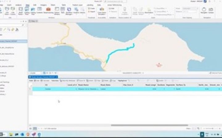
While attending UNOSAT’s first training in Vanuatu, Raviky was inspired by the digitization session and asked the lecturer whether there was a way to repair their road data. Before the training, his team had worked predominantly using Google Earth Pro, and while it is relatively easy to digitize roads using Google Earth, the outcome is always plagued by topological errors and attribution difficulties. However, once the UNOSAT team received the Google Earth data they swiftly converted it into GIS format and repaired the errors.
This is important as the PWD manages the country’s entire road network, which consists of nearly 3,000 km of roads and public infrastructure. PWD had been trying to repair the data for years, which was a particular challenge as their maps were in KML format for each individual island. “There are 83 islands in Vanuatu, that means there are 83 different files” Raviky explained. Although they had a database of raw GPS data and maps, it lacked a link to other information.
That’s when UNOSAT entered to improve their roads dataset by digitizing the KML file to one single shapefile also incorporating road information. Subsequent calls were arranged to explain how the backstopping team fixed the problem to ensure PWD knew how to update the data in the future. Now that the data has been digitized, Raviky’s department can use it for resilient infrastructure planning.
“All the road networks will benefit from this because our work plans are all based on this data. This is a great improvement because we have the whole dataset in just one place. We will have a one-stop shop to help our work.”
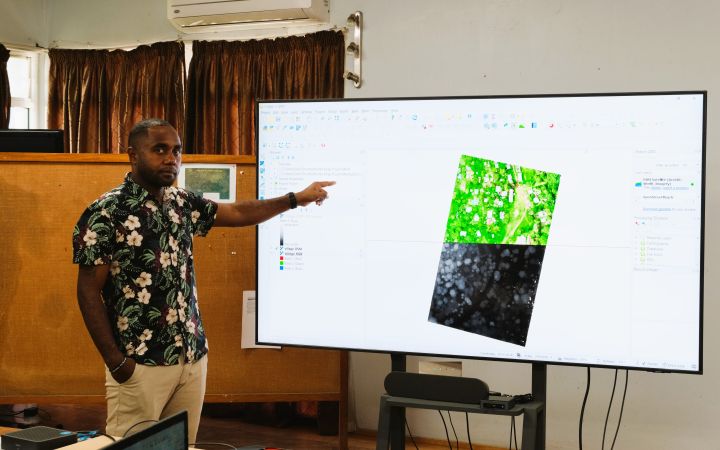
Aside from digitizing the road network, UNOSAT is working with PWD to enhance the use of UAVs or drones using LiDAR to capture the topography of the terrain. Before the Norad project, PWD procured a UAV LiDAR device. However, they were unable to process the data obtained from the drone into useful GIS terrain data, such as digital surface models and digital terrain models.
They were considering purchasing commercial software to perform the analysis but asked UNOSAT for support first. After extensive research, UNOSAT developed a method to generate DSM, and DTM using QGIS, which is a free and open-source software. Raviky and the rest of his department are excited about the results and have asked UNOSAT to train them on this new method.
“Even with the even with the LIDAR data, that was a real roadblock for me before the UNOSAT team came in.”
Now they can generate good contours and utilize that LiDAR data for road design and other infrastructure projects. Raviky informed us “We are planning on using this data to simulate the analysis of coastal inundation”. With the lidar data from the drone and the roads database, PWD will be able to see which parts of the roads need to be targeted for building climate resilience infrastructure.
According to Raviky, without UNOSAT’s support, PWD would have had to send the raw LiDAR data for processing in Australia to convert the data into DEMs and DSMs, which would have taken three to six months from long shipping times. Additionally, purchasing a commercial software license would have cost the department an estimated $3000 to $5000 – savings which Raviky appreciates stating that “using the data in QGIS is a real breakthrough”. Digitizing the road network would have entailed hiring a consultancy, costing the department approximately $10,000 USD.
In addition to saved funds, PWD has seen savings in time. Raviky stated, “We see the importance [of GIT] because this reduces a lot of time in terms of travelling”. The drone allows them to focus on their priority areas and acquire the data they need fast. “With the roads database and other risk reduction support from UNOSAT, we’ll be able to make a decision on which areas are safe zones. Then we can plan future infrastructure. I found the training and support to be very beneficial. Not just for me, but also for the infrastructure sector.”


