At a time when natural disasters are becoming more numerous and frequent, UNOSAT aims to equip all countries with geographical information systems (GIS) to make informed decisions and reduce the risks associated with these natural disasters. To this end, UNOSAT has set up the project ‘Strengthening Capacities in the Use of Geospatial Information for Improved Resilience in Asia-Pacific and Africa’. The project focuses on developing the capacity to use GIS in government agencies across eight partner countries: Bangladesh, Bhutan, Fiji, Lao PDR, Nigeria, Solomon Islands, Uganda, and Vanuatu.
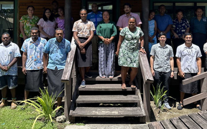
To assess the long-term impact of the capacity development efforts of this project, a focus group discussion was held with three training participants: Colin Laqere, Samisoni Raiwalui, and Diana Ralulu. Colin Laqere and Samisoni Raiwalui are the Fiji Mineral Resource Department's Geological Survey Division officers. Diana Ralulu is a Senior GIS officer in the Fiji Ministry of Agriculture's Land Use Section.
As part of the project, Colin and Samisoni attended the introductory training on landslide susceptibility while Diana participated in the advanced training on Cloud Web Applications. All three participants also attended the Inform Index Advanced Training together. Through these UNOSAT trainings, the officers have enhanced their understanding and use of Geospatial Information Technology in their respective professions. In this article, they share their experiences and how the UNOSAT project supported their departments.
Leveraging UNOSAT Trainings for Organizational Transitions
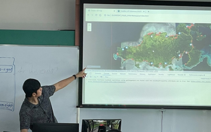
Colin and Samisoni viewed the UNOSAT training sessions as an opportunity to discover advanced tools and techniques in geospatial information technology (GIT), particularly in landslide mapping. After the introductory and advanced training sessions, they acquired skills to produce landslide susceptibility maps with greater precision and accuracy. The informative sessions applying ArcGIS software and regression modelling equipped them to develop advanced susceptibility models better. Preventing losses incurred by landslides is crucial in Fiji due to the high incidence rate following torrential rain and intense meteorological phenomena, such as tropical cyclones and flooding.
During the training, Colin and Samisoni emphasized the importance of consistent data collection to develop advanced landslide susceptibility models. They explained that:
"The training did more than impart knowledge; it instilled a sense of responsibility for data integrity. It is not just about learning software; it is about making sure our data collection is an accurate representation of what's happening on the ground."
Diana also participated in the UNOSAT training, focusing on supervised and unsupervised classification of GIS data. As a senior GIS officer, she applied these techniques to map land uses in specific regions in Fiji. Diana highlighted the critical role of these activities in providing essential data to the management team and senior officers. By leveraging her newfound skills in generating maps through GIT mapping, she successfully pinpointed areas of significant importance, assisting in informed decision-making processes regarding landslide management and prevention. Her efforts showcased how these skills directly contribute to identifying areas in need, making a tangible impact on her organization's strategic initiatives. Using the knowledge gained from the training, Diana has improved her land management and agricultural planning strategies:
"The training has broadened my horizons and given me the tools to tackle complex challenges," said Diana.
Transforming Governance by Streamlining Operations
Another advantage of UNOSAT training is the collaboration among employees from various government departments during the same training. They learn to build the same models and analyze data together, creating uniformity across governmental departments. Samisoni explained that the landslide susceptibility maps he creates in the Mineral Resource Department are also used by the Fiji Meteorological Services for forecasts. Due to the multidisciplinary nature of the participants, the UNOSAT trainings contribute to more efficient information sharing between departments within the government structure.
After the training, the department managers of the Fiji Mineral Resources Department decided to leverage the new knowledge and skills their employees had acquired and update significant software systems. Although the department is still updating its hardware, it already has a significant number of new high-end PCs, making it faster and easier to process the heavy data needed for analysis.
As Colin, Samisoni, and Diana continue to apply their new skills and knowledge in real-life scenarios, Fiji is leading the way toward a more resilient future. UNOSAT training sessions have enabled individuals to harness the power of geospatial technology to more effectively anticipate, mitigate, and respond to natural disasters. By utilizing these new capabilities, Fiji is laying a solid foundation for sustainable development and disaster resilience.


