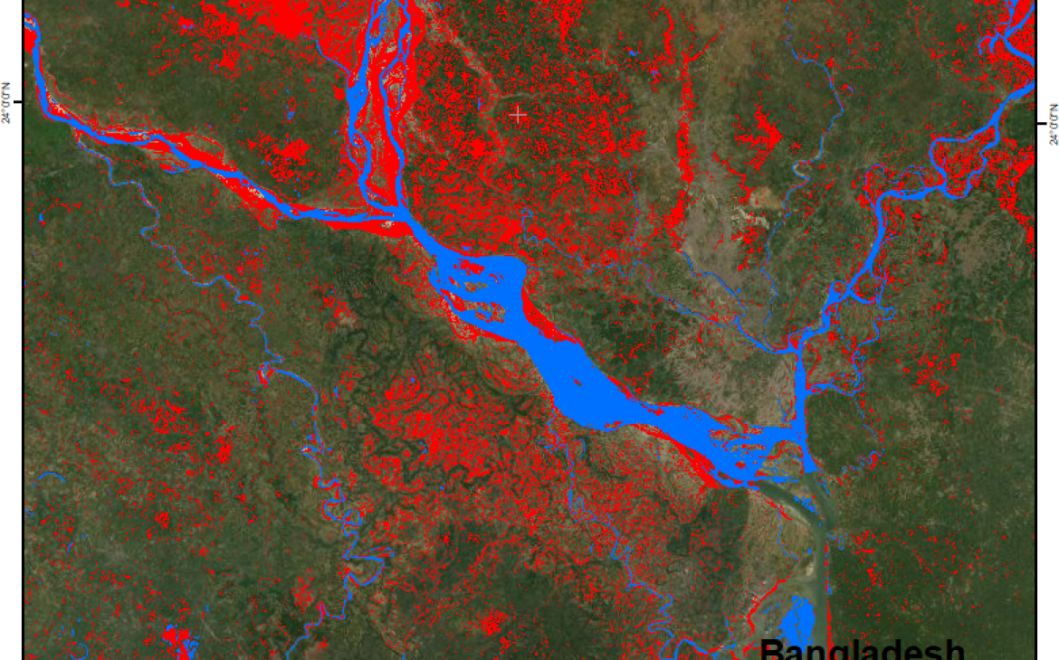
31 August 2020, Geneva, Switzerland - Over the summer, UNOSAT introduced an Artificial Intelligence (AI) based method in its operational emergency mapping service. By reducing the process to a fraction of the time normally needed.
"This fully automated processing method is a game changer for humanitarian rapid mapping operations and a great tool for national disaster management authorities”, Einar Bjørgo, Director, UNOSAT.
Thanks to its extensive experience in rapid mapping, UNOSAT has collected a vast library of historical flood datasets, which are extremely useful to develop machine learning-based methods. By using AI, satellite based analysis and related mapping are completed in considerably less time and the process is almost fully automated. This not only informs the decision-making process to help optimize the disaster response, it also has the potential to significantly reduce loss of life and mitigate structural damage, particularly in the context of humanitarian operations, thus supporting both national authorities and international emergency management organizations for the benefit of local populations.
“The use of AI for flood detection enables the analysis and processing of large quantities of images in a short time span, which allows for better analysis and wider geographic coverage” Samir Belabbes, UNOSAT
During the past year, UNOSAT’s team, in collaboration with Wuhan University and UN Global Pulse, trained machines extensively to process satellite images and detect water much more rapidly in comparison to semi-automatic methods. With this new approach, radar images from the European Space Agency (ESA) [1] are automatically downloaded, orthorectified and processed by UNOSAT’s AI model to output disaster maps, with limited need for human intervention.
In recent months, UNOSAT’s Rapid Mapping Service has been monitoring the situation related to seasonal rains and potential floods in the Asia-Pacific region with a particular focus on countries potentially affected by the southwest monsoon season that runs from June to September 2020. In this context, we ran the AI algorithm for the first time in July 2020 for operations in Bangladesh.
UNOCHA, in close coordination with other UN entities and the Bangladesh authorities, contacted UNOSAT on 13th July 2020 to assess the needs after monsoon rains flooded a large part of the country, in particular along the Brahmaputa river and in the northeastern parts of the country in the Sylher district. To respond to this activation UNOSAT decided to trigger the International Charter: Space and Major Disasters, and applied both automated and semi-automated analysis methods.
Take a look at the webmap for this activation.
With this experience using AI to monitor the monsoon season in Bangladesh, we were able to invest part of the freed-up time into making the products more accessible and visually appealing for the emergency response teams on the field.” Suwanan Sateiandee, UNOSAT.
Later in the month, UNOSAT's rapid mapping service supported both the government of Myanmar and Humanitarian Information Management Unit (HIMU) with satellite imagery analysis, including AI-derived outputs, after large swathes of central Myanmar were flooded by monsoon rains.
Our team is also working with the National Institute of Disaster Management (INGC) and the Ministry of Science and Technology, Higher Education and Technical-Professional (MCTESTP) of Mozambique to set up an operational AI-based flood detection platform. This platform aims to support INGC and other national stakeholders with near real time satellite-derived analysis and statistics about potential flood events during the coming rainy season (from October 2020 to April 2021). Similar portals will also be developed for other national disaster management authorities.
Going forward we intend to further develop Artificial Intelligence applications for rapid mapping by focusing on the user experience and scaling up how we monitor flood-prone areas. This entails further training for the machines and automatic communication between the AI algorithm outputs (disaster maps) and the visualization dashboard developed by UNOSAT.
[1] Copernicus Open Access Hub operated by ESA accessible online at https://scihub.copernicus.eu/dhus/#/home


