March 2019, Geneva, Switzerland – The UNOSAT Rapid Mapping Service has been supporting the humanitarian community with satellite imagery analysis for over 16 years. The service was established in 2003 to meet the demand of United Nations agencies, Member States and other humanitarian agencies for rapid mapping and satellite derived analysis in the wake of disasters and complex emergencies.
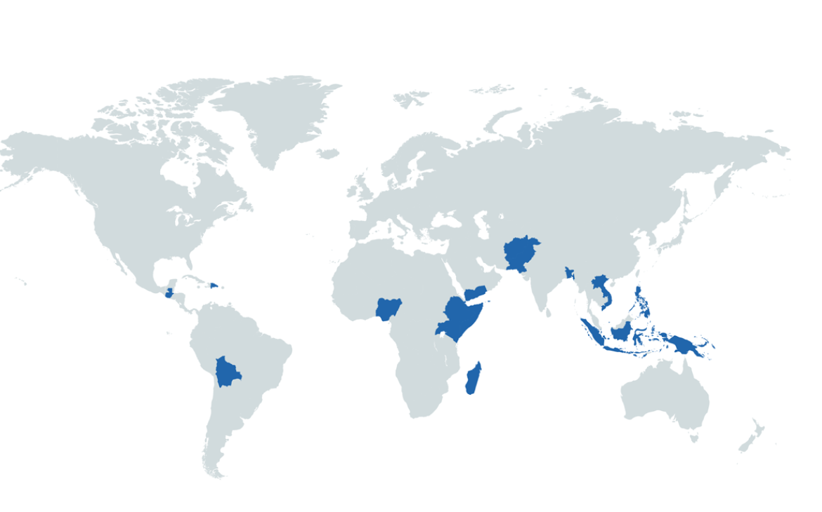
Last year, UNOSAT assessed 28 humanitarian crises resulting from natural disasters in 22 countries* across Asia-Pacific, Africa and Latin America upon request from sister UN agencies, governments and humanitarian organisations.
Looking into the total of 95 service products produced in 2018, floods make up the largest portion of mapping work, being at 61%. More than one fifth (21%) of the total products are about tropical cyclones, and it is followed by earthquakes and volcanoes with 7.5% each and landslides at 3%. In other words, flood mapping and monitoring represent significant activities of UNOSAT Rapid Mapping Service, as it often requires continuous observation over time, such as identification of the region affected, spatial extent of inundation, population exposure and accessibility, flood damage statistics, flood progression and recession, etc.
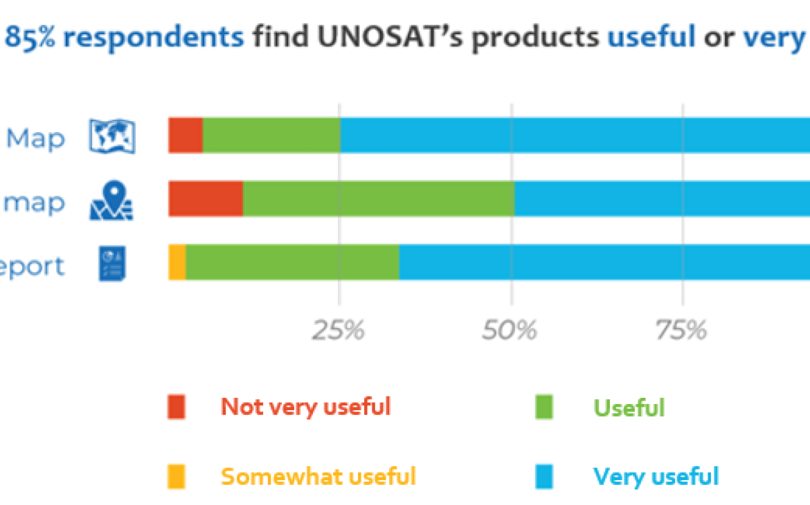
UNOSAT surveyed the requesters and end-users of its Rapid Mapping Service products on natural disasters in 2018, and the result shows that more than 85% of respondents find the products useful or very useful. Maps, web-based live maps with the latest information and reports enable decision makers from various levels to gain a timely and accurate overview of the situation and make informed decisions with an aim to reduce risks and optimise limited resources. In addition, data sets for geographic information systems (GIS) experts are also provided via various channels and in diverse forms including GIS vector data and GDACS-SMCS, which contribute to improved coordination as well as in-depth monitoring and reporting.
As for the quality of service, 90% responded that information derived from UNOSAT products and its timeliness were very good or excellent. Moreover, the communication with UNOSAT was considered efficient or very efficient at 87%. Nearly 97% of respondents said that they are very likely to request and use the UNOSAT Rapid Mapping Service (maps, data, analysis, reports, etc.) again in the future.
The users’ testimony reaffirmed their high satisfaction of UNOSAT’s service.
Marcus Elten. Humanitarian Associate Expert, UN OCHA
Throughout the process, communication was very responsive and timely. Somalia Floods - 07/05/2018
Kumudu Sanjeewa. Information Management Officer, UN-OCHA ROAP
During our field visits, we found UNOSAT/UNITAR damage analysis accurate in most areas when compared wot the actual situation. Tonga Tropical Cyclone - 09/02/2018
Adish Maudho. Information Management Officer, FAO
All the derived products are categorized as essential for response and recovery but not only, as institutions, partners and stakeholders have now a good basis for futue development planning. The flood report is indeed very useful in identifying most at risk areas and assessing the extreme rapidity of flash floods. Djibouti Floods - 20/05/2018
Dale Wilson. Climate Change & Resillience Consultant, WFP
The data and products were very useful to assess the scale of the flash flood events and support the early recovery activities including rapid food security and agriculture assessments. Lao PDR Floods- 24/07/2018
Besides the mapping service, UNOSAT also delivers training and workshops to enhance the capacity of disaster management professionals to use geospatial technologies for Disaster Risk Reduction. More than 85% of survey respondents expressed their interest in attending a future UNOSAT training to improve their use of GIS and Remote Sensing in humanitarian operations.


