Following a five year engagement by the United Nations Institute for Training and Research (UNITAR) to conduct applied research and geospatial analysis on piracy activities, this report constitutes the first global geospatial analysis on the issue. What started with identifying captured ships delivering humanitarian assistance and other goods using satellite imagery later expanded to regional geospatial analyses for the western Indian Ocean. The current report assesses piracy at the global level. This research includes detailed geo-spatial analyses, while relating findings to complementary factors, including references to specific examples illustrating the complexity of the piracy issue. The report also covers the financial aspects of global piracy, as well as anti-piracy activities and future outlooks in a changing meteorological climate.
The work takes into account studies from different sources, such as UN sister agencies, academia, insurance industry, shipping companies, European Commission and the World Bank. This report should be seen as a contribution to the important and ongoing debate on maritime piracy taking place in numerous fora, including the Contact Group on Piracy off the Coast of Somalia and others.
This research and present report have been made possible thanks to financial support of the Government of Sweden.
Executive Summary
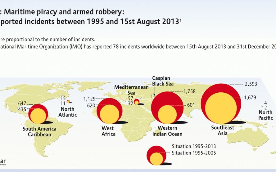
This global report on maritime piracy has identified several important trends related to maritime security. Based on a refined and detailed analysis of primarily data from International Maritime Organization (IMO) Global Integrated Shipping Information System (GISIS) «Piracy and Armed Robbery» module - International Maritime Organization (IMO) Global Integrated Shipping Information System (GISIS) - UNITAR has been able to explore how trends in geospatial patterns and severity of reported piracy incidents are developing, from 1995 to 2013.
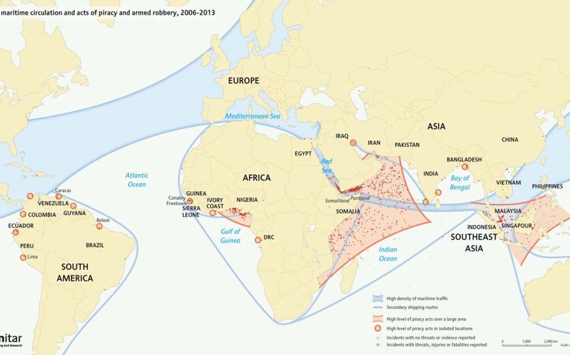
Some detailed geospatial analyses focus on the period 2006-2013 due to improved records for geo-locating incidents. Our analysis includes the added cost of piracy for the maritime industry at a global level and how these are linked to anti-piracy initiatives. Furthermore, costs related to paid ransoms and effects on the local economy in piracy land-bases are explored. There are two areas where significant trends in piracy activities are observed: the Western Indian Ocean, including the Gulf of Aden, and the Gulf of Guinea. In other areas, notably eastern Indian Ocean, including the Malacca Strait, and in South America, no major trends are observed. While activities in South America are relatively minor, piracy in the Malacca Strait continues to be a major disruptor for safe routes in the eastern Indian Ocean.
As for the Western Indian Ocean, several main observations are made:
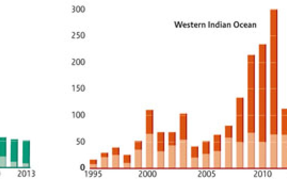
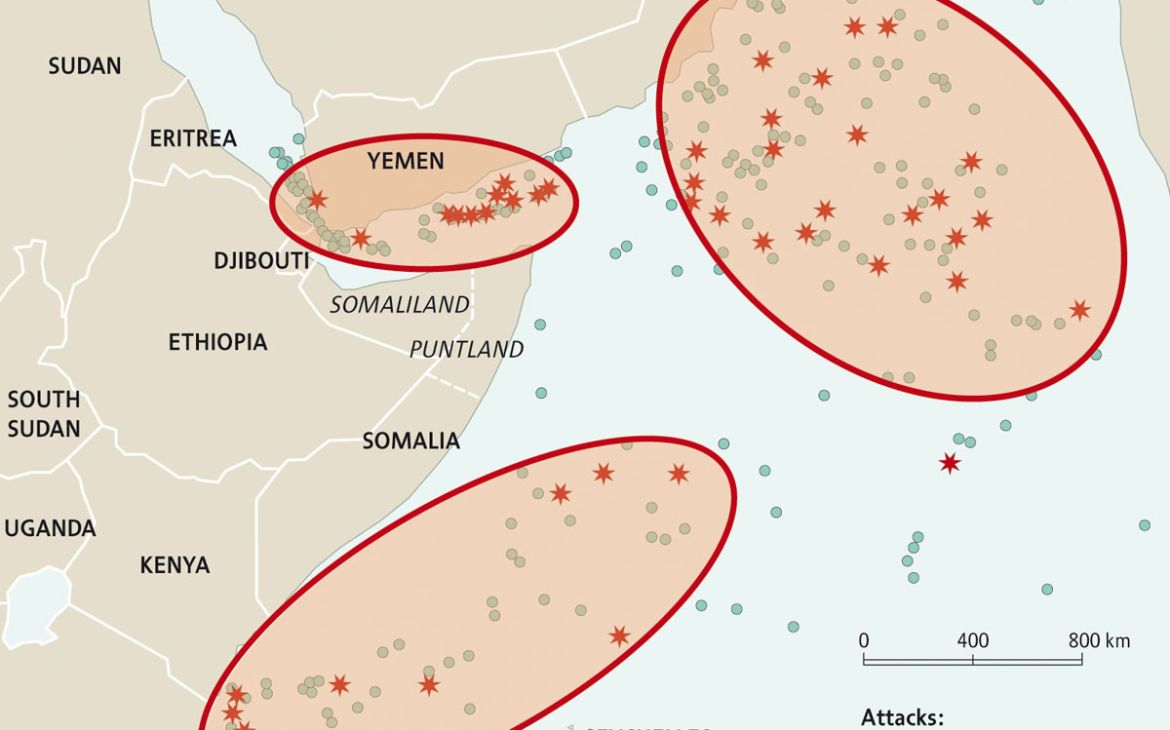
There has been a significant reduction in the number of pirate attacks during 2013 – to the extent one can claim they have almost stopped (28 incidents in 2013, of which only 8 since 15th August). Not a single vessel was hijacked;
- The median distance from where an attack is reported to the nearest coast has dropped from close to 400 km in 2010 to under 50 km in 2013, thus indicating a considerable reduction in the radius of successful pirate activities;
- Incidents involving the use of rocket propelled grenades, relatively heavy armour for pirates, has decreased from 43 in 2011 to 3 in 2013;
- Ransom amounts paid to pirates have decreased from US$150M in 2011 to about US$60M in 2012;
- In addition to the well-known feature of piracy “mother ships” from which fast-going skiffs can radiate, a new trend of floating armoury vessels supplying anti-piracy entities with weapons out in international waters is observed.
In the Gulf of Guinea, the trend is to some degree different of that in western Indian Ocean, although at a smaller scale in terms of number of attacks carried out:
- The number of attacks show no sign of decreasing;
- Attacks in the high seas have increased, while attacks in ports are on the decrease;
- The types of attacks have gone from low-intensity towards more violent acts;
- The Financial losses to the national economies for countries with ports in the Gulf of Guinea are considerable. This has forced certain countries to take military action that has proven successful.
In southeast Asia/Malacca, we observe a slight decrease although no significant trend in the number of attacks, or in their severity.
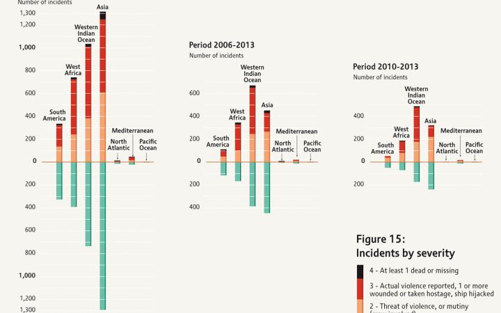
Following the detailed review of IMO’s database structure and in-depth data analysis, a “severity index” to better differentiate the gravity of reported incidents is proposed for future data collection and analysis.It is important to know that close to half of all piracy incidents reported globally are not what can be considered severe, i.e. no threat of violence has been reported.
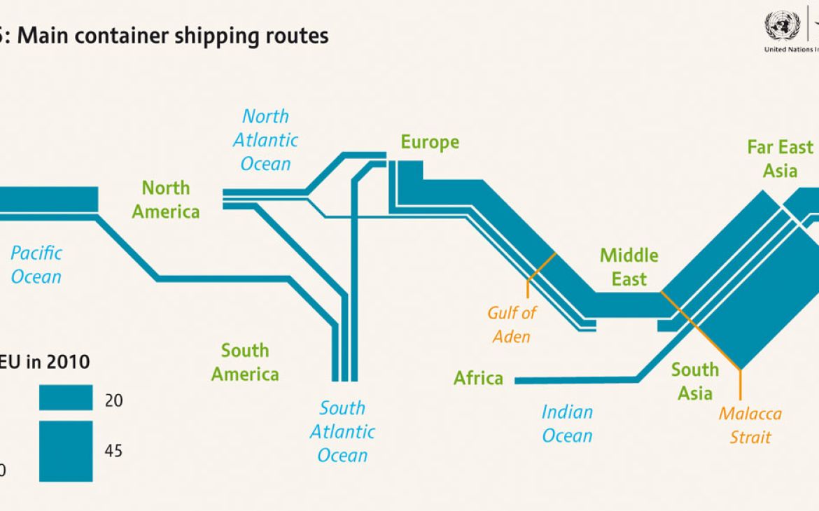
With studies indicating a significant shift of the centre of gravity for marine activities to Asia, finding solutions to reduce or end piracy is not only a major security issue, but an important economic factor. With changing climatic conditions at high latitudes and medium-to-low-income countries in Asia experiencing the largest growth per capita, additional transport routes may be explored, including combined pipe-lines and secure area marine shipping routes.


