
Flood Prone Areas in the Greater Horn of Africa on the Map
20 April 2016, Geneva, Switzerland – The weeks between March and May usually constitute the rainfall season over the equatorial sector of the Greater Horn of Africa (GHA) region. During this rainfall season, floods are one of the most frequent hazards. The Intergovernmental Authority on Development (IGAD) Climate Prediction and Applications Centre (ICPAC) provides regional updates on a regular basis to its member states. In order to further improve disaster preparedness efforts and overall disaster management, UNITAR-UNOSAT & ICPAC are releasing a first of its kind freely accessible 90m Flood Hazard Map of the Greater Horn of Africa.
Building Capacity for Disaster Risk Reduction Using Geospatial Technologies in the Horn of Africa
Both organisations have a long-standing collaboration, thanks to a multi-year programme funded by the Government of Norway. One of the objectives of this programme is to increase the capacity of IGAD and its member states to perform mapping and data sharing in support of Disaster Risk Reduction (DRR) and early warning. The development of the Flood Hazard Map for the GHA fits into this bigger project and complements the information currently available on ICPAC’s website.
Flood Hazard Map for the Greater Horn of Africa
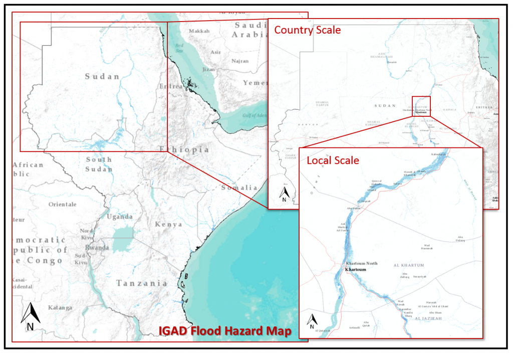
The Flood Hazard Map was first presented during a workshop hosted by UNOSAT and ICPAC during the 42nd Greater Horn of Africa Outlook Forum (GHACOF-42) in Kigali (Rwanda) back in February 2016. It consists of a riverine flood hazard assessment at 90m resolution (pixel resolution) for ICPAC member countries (Burundi, Djibouti, Eritrea, Ethiopia, Kenya, Rwanda, Somalia, South Sudan, Sudan, Tanzania, Uganda) showing the extent of potential flood events using a statistic approach based on river flow data (with a return period of 25 years). Inundation patterns are shown in dark blue while permanent water bodies (major rivers and lakes) are in light blue.
Accessible on ICPAC website as a new layer in the live web-map for GHA this map is not only designed to increase awareness on potential extent of flooding among the public and local authorities, but can be used by any other organization working at reducing impacts of natural hazards. This information can be used for identifying population at risk, land use planning, inform flood mitigation activities and planning for effective emergency response for example.
This new tool is a result of a fruitful collaboration between UNOSAT, ICPAC, CIMA Research Foundation and USGS and will reinforce ICPAC’s primary goal of providing early-warning of climate-related risks to its member states, thereby strengthening preparedness efforts.
Related Links
Live web-map for the Greater Horn of Africa region